Monday, April 21, 2014

A Coon Hollow Adventure

A Coon Hollow Adventure

Preparing Coon Hollow for Rock Junction, 2014

April 19, 2014
By Jerry Smith

With Rock Junction looming only a little over a month away, (June 3, 4, & 5, 2014) pre-running the premier western Colorado and eastern Utah trails to ensure their readiness is necessary.  Winters in this part world can be tough on our trails.

Members of the Grand Mesa Jeep Club had already reopened Granite Creek.  After several years of neglect, the roadside brush had grown into the road making forward progress a paint removing process.  Read about that trip at: 
http://happytrails4wdblog.blogspot.com/2014/04/the-granite-creek-trail.html

The Granite Creek trail

The Calamity Mesa Loop had required moving large rocks and downed trees from the trail to allow “unfettered” access.  Check out the story of the Rock Junction 2013 -- Calamity Mesa Loop at http://rockjunction2013calamitymesaloop.blogspot.com

GenRight's Tony Pelligrino on the Calamity Mesa Loop
Next, the Coon Hollow Jeep Road would no doubt need some maintenance.

The Coon Hollow Jeep Road was reopened to full-sized vehicles in 2013 after many years of non-use.  You may read about that at: 
http://coonhollowisopen.blogspot.com/2013/06/Coon-Hollow-Jeep-Trail.html  
The first wash on Coon Hollow in 2014
The first wash on Coon Hollow in 2013

Tree branches, mountain ash, and miles of 5-foot tall sagebrush had overgrown the trail to barely leave room for ATVs to pass.  Now, it allows access to an area with “Wilderness Characteristics”… funny how some people can ignore the presence of a road to fulfilling their insatiable desire to name more “Wilderness”.
The winter of 2013/14 had been a long, cold, and harsh one.  Erosion on other area trails had shown to be severe.  With several deep washes to cross, Coon Hollow would no doubt need some tender loving care.

The morning of April 19th was somewhat ominous.  Already raining, the forecast was for more rain.  Much of the land north of the Colorado River is not conducive to wheeled travel when wet.  The mud can be treacherously slick and even dangerous.  Coon Hollow is north of the river.

The trip had been advertised to LEAVE from the Clifton “Albertson’s” parking lot.  Albertson’s has not existed in Clifton for years.  Confusion deluxe!


Happy Trails in the wash
Not realizing the error at first, I sat at the City Market parking lot thinking that it was the correct place.  At nearly 8:30, Greg comes driving up saying he saw Adam over near the former Albertson’s waiting… so we left for there.

Meanwhile, Adam had gone seeking any others hoping to go.  Finally, the CB radio allowed all to convene and we dashed up I-70 toward De Beque.

After airing down in De Beque, we proceeded to the Coon Hollow road.  Even though it had just rained, the road was only damp.  Good luck was with us.

Entering the canyon, we noted several deep cuts across the road from erosion.  Some were bone jarring to cross.

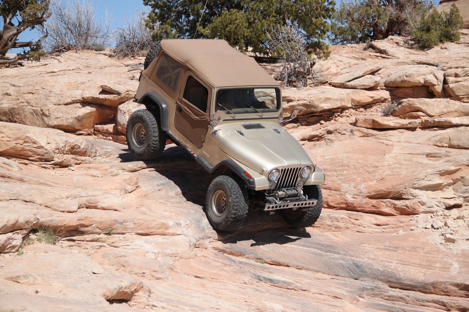
Coming to the first large deep wash crossing, Jerry led down the extreme grade into the wash.  Bad decision! 

The wash was nearly two feet deeper than the last year and had exposed a substantial boulder in the bottom that was hidden from view over the hood.


That is a "full-stop" rock!

The wet road surface disallowed any kind of stopping power and we ended up nose down in the wash up against the huge rock.  Backing out was impossible without help.  I should have looked this over on foot BEFORE entering!  (a lesson I learned years ago and usually follow)

Greg’s winch was double blocked to the rear of Happy Trails and dragged her out with little trouble. 

Looking the situation over, it was decided that a much larger crew would be required to “remedy” access through the wash.  The only other avenue would be to scout another route.

Walking back down the road, we found access to and from the wash circumnavigating the former crossing. 


Adam crawling the wash
The only reason we pursued this action was because this area is still considered “Open” travel by the BLM.  If it had been managed under other circumstances, we would have been done for the day. 


Greg rocking the wash
Soon we were back on the trail and wondering; “what’s next?” 

Luckily, we found the road in fair condition clear to the top of the first shelf road.  There, with the damp surface, the nasty off-camber turns entering the small canyon were going to be a bit of a challenge.

Dry, the corners are banked enough to slide you into the deep, rocky wash bottom.  Wet, well let’s just say there were new rules.

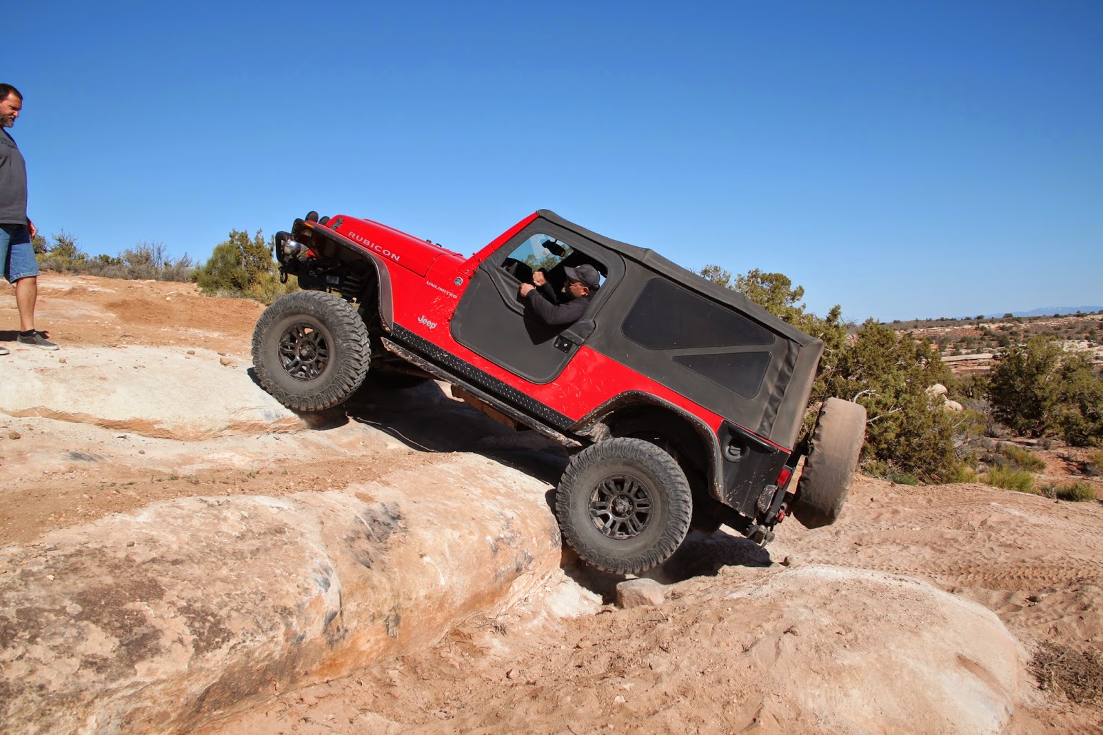
This wash is narrow with large rocks littering the bottom.  Good tire placement is required and you WILL experience some severe off-camber as you wind your way through the S-turns.


Adam in the off-camber turns
After negotiating the wash, it was on to the next shelf road section.  This steep hill has many sizable rocks that you must crawl over.  Some are large enough that if you aren’t careful, you will hang your axles on them.  Again, add the mud factor on round rocks.


Greg assumed the off-camber position

Soon we were traveling up the hogback ridge.  Often, we stopped to trim Juniper and Mountain Ash from the road. 

About half way up, the skies turned dark and began to wet everything.  The road became slick in the extreme.  Walking was tough while trimming.

About 500 yards from the top, the trail becomes quite off-camber and steep.  The road by this time was saturated and treacherous.

Jerry finally spun-out and had to apply the lockers to continue.  Adam and Greg were sans lockers and Adam spun-out about 2/3 the way up.  This was a very bad situation.


This is a common position on Coon Hollow
The only sane (?) thing to do was to back down to where we could turn around.  That, it looked like, would be dangerous and difficult.  The cold rain coming down wouldn’t improve the situation any either.
Hands and fingers ached from the cold before we were through.

Walking on the road was like walking on a steep, icy hillside.  The only saving grace was most of the way; there was a small berm on the lower side of the road with thick brush growing from it.

We started walking Adam back down the hill.  Every time he tapped the brakes, sliding out of control was all he could do until enough traction was found from the small amount of growth on the road surface.

Several times the Jeep slid nearly off the road toward the steep mountainside below.  You could hear the seat covers ripping.
Finally, we reached Greg’s rig and started the whole process over with him behind the wheel. 
Finding rocks was no problem
Way down the hill, a wide spot appeared and we turned Greg around.  Back up the slick road, we mushed to Adam’s Jeep.  It was like “Peat and Repeat”.

Then it was trudging back to Happy Trails, about a quarter mile up the hill.  All this walking on the rain-slickened road was getting very hard on a guy who just weeks ago had open-heart surgery.

At Happy Trails, it was decided that I would drive up to the top to gauge how much further it was.  Greg and Adam were willing to walk up if it wasn’t too far.

By the time I could see the top and get turned around, they were nearly caught up to me.  We continued to the top of the saddle where the views are tremendous.  This is where I made another mistake.
Down the other side, the road normally takes you to a great lunch spot.  I thought about driving down to it.  BAD idea!

Just a few yards down the hill, it was apparent that the only “down” was down the steep hill… off the road sliding sideways.

The only option was to tie the winch line to a small Juniper above the road and swing the rear downhill.  Then winch back up to the road where we could switch the anchor to another tree and begin turning back onto the road.

One of the smaller wash crossings causes one end or the other to plow
Luckily, this plan worked perfectly and soon we were on the way back down to the other Jeeps.  Going down forward was much easier than backing.

A late lunch was held before we headed out.  Coon Hollow is one-way in and out.  The look of the trail is dramatically different going down than going up, though.  It’s like two different trails altogether.
Going up, it’s like looking through a tunnel of trees.  Descending, you can see the entire canyon and town of De Beque and the Battlement Mesa behind.  Gorgeous!

The Coon Hollow Jeep Road will require a heap of work to allow continued access for the foreseeable future.  The wash will likely require a rock dam be built below the road with some screen to catch and hold sand and silt.  This will allow the road crossing to be raised to a level of usability again.

Until that, the bypass will have to suffice.

Despite the difficulties, this day turned out to be quite an adventure for the three brave hearts.  A ton of work was performed and some new experiences had.  We look forward to doing it all again.

One last thing we have to cover; “When you come to a fork in the road… take it!”  Who knows?  You might find another gem like this one.
Many Happy Trails to and for you.
Copyright Happy Trails 4wd 2014- 2017.  All rights reserved.


Sunday, April 6, 2014

The Granite Creek Trail

The Granite Creek Trail

In the Lower Delores River Drainage

By Jerry Smith

April 5, 2014

The Granite Creek trail is one that has had little use by full-size vehicles for several years.  Gamble Oak and Juniper trees had grown into the trail leaving little room for full-size vehicle access.  Even the overhead is grown over in places.

The Granite Creek trail takes you through some spectacular Colorado and Utah Canyon Country.  Deep within the canyon, one has no idea when you cross from one state to the other unless you closely watch your GPS.  That requires a great deal of concentration as the scenic values of this deep canyon and the trail keep your eyes quite busy.

For years, the Grand Mesa Jeep Club (Colorado's Club of the Year - 2013) has been discussing this as an opportunity for a “club project”.  Reopening trails closed by Mother Nature has been an annual endeavor by a few club members.  Last year they reopened the Coon Hollow Jeep Trail after Mom Nature had physically closed it for years.

Shortly after the 8 AM meeting time, we struck out for adventure with a side dish of work from the Albertson’s on Broadway in Grand Junction, CO.  In no time we were weaving our way through the east entrance to the Colorado National Monument.  What a way to open your sleepy eyes on a cool Saturday morning.

Passing through Glade Park, we picked up the last member of our group – totaling 11- vehicles.  A great turnout considering we intended to begin what was billed as a two-day work project.

Roy proved to be "the workhorse" on this trip
At the Colorado/Utah border, those who desired to do so, aired down.  Most members elected not to drop air pressure for the short roughly thirty-mile drive to Granite Creek.  Some lived to regret that decision.

The road along this route is generally rated easy and recommended for stock vehicles.  Last fall, we encountered more difficulty than would be normally expected on our way to Gateway, CO.  Snow has a way of increasing the difficulty of many trails.

Melting snow and slick mud made this hill a challenge for all

This early in the spring, some snow and mud was anticipated in the higher elevations of upper Granite Creek.  That would only add to the “fun” in achieving our destination… until we learned that Jason’s Grand Cherokee was without a front driveline for the day.

One rocky hill climb proved to be too much for the 2wd vehicle and Roy came to the rescue with a tow strap.  Then we crossed upper Granite Creek and encountered a steep, rocky, muddy, and melting snow covered hillside.

Jason again hit the “automatic reject feature” button and required a tow from Roy.  It took several tries to find a line to get them up the greasy hill, but Roy made it look easy once enough traction was found.

The next one to find that same reject button was Collin in his carbureted CJ.  The incline caused the engine to cough and sputter to a halt mid-way up the hill.  Once again Roy came to the rescue.

Lost Horse canyon has some awesome scenic values as well
Not long thereafter, we turned off the main trail and entered Lost Horse canyon.  After a few miles, this canyon intersects with the main Granite Creek canyon and proceeds westerly. 

After entering Granite Creek, there were many stops for brush trimming parties.  Several trimming tools and a chainsaw were put to good use for the next few miles.  Gambel Oak and Juniper trees were trimmed back to allow for full-size vehicles to pass without fear of losing paint to the stiff branches.

Hoo Doos and arches adorn the Granite Cr. canyon rim
Last fall, on another trip to the region, several club members had walked down from the top of a steep, really rocky and narrow shelf road that drops you into Granite Cr.  They reported one rock protruding from the upper hillside that barely left room for Luke’s narrow CJ to pass by.

The rest of the trail was said to be grossly rocky, dangerously narrow in places, and quite steep.  It sounded like my kind of trail.

Upon reaching what Harley refers to as “the Homestead”, we could see the steep shelf road along the side of a steep box canyon.  This would be the end of the brush trimming for the trip.  We had done in a day what had been predicted to be a two-day project… so far!

After exploring the “Homestead”, we began ascending the lower tight switchbacks to the shelf road visible from below.  Once above the switchbacks, the road became even more narrow and very much more rocky.

Ascending the the tight switchbacks to the shelf road exit
Many of the rocks were of the size a small-tired vehicle must totally avoid.  Some caused a terrific view from the passenger side of the box canyon on the lower side of the road as the outside tires searched for something to hang on to.

To give an additional understanding of the word “steep” when describing this section of the trail, Collin’s CJ stalled again requiring Roy to back several hundred yards to provide assistance.  Roy certainly proved to be a major asset to this trip.

The narrow shelf road crawls a steep cliffside
Having attained the mesa top, we found that we had used up the majority of sunlight for the day.  No time was squandered getting back to the end of DS road at the CO/UT border where we aired up and split up into smaller groups for the drive back to town.

We offer many thanks to all participants for all their patience, cooperation, and hard work in reopening another trail.  To some, new experiences with using a tow strap and brush trimming tools were a source of learning.

The Grand Mesa Jeep Club ascending the shelf road on Granite Cr.
Reopening a trail is a joy that not many of the wheeling community have experience with.  Yes, it can be a lot of work, but it is done with the knowledge that the worker and many others will be able to enjoy these trails well into the future… barring any land managers and “Preservationists” getting in the way.

This box canyon is what you avoid while climbing the shelf road
This day was loaded with learning and working experiences for all.  It also provided for a great day of Jeeping that our memories will hang on to for a long, long time.

Hopefully, the Granite Creek trail will remain open to excite many seeking an adventure in a wonderful part of the great American BackCountry.

Note the narrowness of the road near the JK.  You get a dandy view there!
One last thought you should remember; “When you come to a fork in the road… take it!”

Happy trails.

Copyright:  Happy Trails 4wd – 2017.  All rights reserved.
Looking back down at the "Homestead"
This is a rocky trail
Steep and narrow, but oh so beautiful

Winding along the narrow shelf road


Friday, April 4, 2014

The Sevenmile Rim Trail

The Sevenmile Rim Trail

Moab, UT

March 23, 2014
By Jerry Smith

For several weeks the thought of a 3-day Jeep trip to Moab had haunted the minds of several Grand Mesa Jeep Club members.  A few of the luckier ones were planning on an even more extensive trip, making the rest of us jealous.

Mike crossing what he calls "the Silver Crack".
Mid to late March in Moab can be slightly “iffy” as far as the weather is concerned.  Cold nights (lower to upper 20s) and warm days (upper 30s to lower 60s) make for some “cozy” camping conditions and excellent “on the trail” days.

Still recovering from open heart surgery, I was under Doctor’s strict orders not to lift any more than about 10 pounds which precluded me from even packing my tent cot in the back of Happy Trails (my ’06 Jeep Rubicon), so I was limited on how much “camping” I was up to. 

Here's Roy flexing his CJ on the "Silver Crack".
Add to that the fact that getting cold was not an option… shivering with a still healing chest is more than just painful.

The weatherman had been saying all week that Sunday would be “the day” to be out, so Sunday it was.  The trip planned for the day was one I had not done before, so everything was working out perfectly.

Flexing to the point of unloading a coil spring.
The Sevenmile Rim Trail is rated as “Difficult” in Charles Wells’ “Guide To Moab, UT – Backroads & 4-Wheel Drive Trails” book.

Happy Trails stretching on the "Silver Crack".
With sights like Uranium Arch, Monitor and Merrimac Buttes, overlooks of Arches National Park, the snow capped La Sal Mountains, and Determination Towers to look forward to, this day promised to be legendary. 

The notorious obstacle “Wipe Out Hill” along the trail was a major draw as well.  Having heard many stories of success and failures on this famous Moab obstacle brings a quickening to your heart rate if you’re into Jeeping in a big way.  These famed Moab obstacles don’t come by their reputations lightly.

Leaving Grand Junction at about 6 AM meant driving I-70 in the dark.  That proved to be a blessing in a way.  Extreme eastern Utah along the interstate can be pretty boring.  The silt left behind from the prehistoric seas apparently has little to offer plant life, not even sagebrush will grow there. 

The sun was just breaking the horizon as we were passing the Hwy 191/313 intersection where we were to meet later.  Gas and a small breakfast were awaiting us in Moab.

Lined up and ready to go.
Returning to just north of the 313 junction, I patiently awaited the rest of the troops.  I spotted a Jeep that looked like Roy’s CJ go by and then Cody Lange turned in to tell me we would be assembling at the 313 intersection as mentioned in the trip preliminary. 

By the time we got to the assembly area, most of the day’s trail seekers were already lined up and ready to hit the trail.  Mike Ehlers was to become our trip leader and we followed him a short distance up Hwy 191 to the turnoff.

The actual trailhead is well marked by a metal sign some distance from the highway turnoff.  From here, the trail begins getting rough and rocky. 

Climbing the mesa on the Sevenmile Rim Trail.
A fairly steep grade becomes ledgy as you change altitude and pass through different layers of sandstone strata.  Some of the more difficult ledges have by-pass opportunities if you choose to use them.  Most of us didn’t.

Ascending the Sevenmile Rim Trail.
The views to the east get more dramatic as you ascend the mesa to the south.  Unfortunately, there was a haze that spoiled our views looking into the eastern sunlight… blurring our views of Arches National Park and the magnificently snow capped La Sal Mountain range.

Not long after reaching the top, we stopped to “play” on some tall slickrock ledges just off the trail.  It was here that I left a large piece of my previously broken left front fender flare hanging in a Juniper Tree as we passed by a little too close.  A set of Bushwacker flat fender flares have been on the agenda all winter… now they seemed a lot more important.

"Playing" on ledges just off the trail.

The new flares require the Jeep body temperature to be above 60 degrees for the double-sided tape to adhere properly, so we’ve been waiting for warmer days to order them.

LJs nearly dragged the belly on these steps.

The next few miles of the trail weaves near and away from the east rim where views of Hwy 191 traffic below look like small matchbox cars.  Further east is Arches National Park.  Some arches were vaguely visible through the haze.

A little to the south shown the La Sal mountains with their white crests gleaming through the haze.  On a clear day, this would make for some great “Kodak moments”.

Luke found this to be "as far as you go" on these ledges.

Not too far along we passed the first road to Uranium Arch.  Trip leader Mike was looking for another road to it and left us setting beside a second road to the arch while he searched for a painted rock.  Not finding the painted rock, he returned to the group and took us down into Uranium arch where we held a lunch break and did some exploring on foot.

Roy hitting the "Automatic Reject Feature" button.

Arches are phenomenons that always seem to hold one in awe.  When you stand under or on one, you just can’t help wondering how they form and how long they will exist before crumbling into a heap of broken rock. 

Uranium Arch from below.

How awesome it would be if one could live long enough to watch one form… though you might want another interest or you could become quite bored after a few thousand years of watching sandstone wear away.

Uranium Arch from above.

After driving further south for a while, the trail arcs to the west toward Monitor and Merrimac Buttes far in the distance.

Happy Trails about to lose the front fender flare to the tree.  
Approaching the buttes gives a new perspective of the sizes of these monoliths.  From seemingly nowhere, these two giant sandstone mountains with vertical cliffs hundreds of feet tall just jut from the earth.

Eons of weathering are evident as you get closer.  This makes you wonder how long they have existed and how they came to be there.  (must have been one large jack that raised them from the earth below)

Cody making ledges look easy.

After passing between the buttes, we encountered some off-camber trail and a narrow passage between the “rock and a hard place”… literally.  Your outside mirrors are in peril as you maneuver through at about 25 mph. (yeah, right) 

Not too far from the narrow spot, the trail takes a few turns leading to a steep side-hill of slick rock. 

Crossing the off-camber slickrock. 

Here, you must climb a steep slickrock approach that leads to a looong arc crossing a very off-camber slickrock side-hill that LOOKS much worse than it seems as you drive its length. 

Roy climbing to the off-camber slickrock arc.

At the far end of the severe off-camber, you drop down a very steep slickrock grade to the sandy trail below.  Not far from here is one of the very famous Moab obstacles… Wipe Out Hill.

Cody descending the slickrock hill.


When going to Moab, there are certain obstacles that stand out by reputation.  Wipe Out Hill is one of these.

Mike descending Wipe Out Hill.

Going down is plenty rough on the seat covers as you feel like you’re standing almost vertically on the hillside.  Your tires will chirp in places as you attempt to slow your descent.  Yeah, it’s steep.

At the bottom is a small flat where you must turn around and get a new view of how much trouble you just got yourself into.  There are a couple of lines you can take to extricate yourself from this pit.  One very steep slickrock track and one extreme, loose rock shelf that only the large tire guys can run.
Roy climbing Wipe Out Hill.
Roy descending Wipe Out Hill.

After watching others in our group make the descent and then ascend the hill with no trouble, I pointed Happy Trails down the trail… turned around, engaged the ARB lockers and proceeded toward the top.

Happy Trails on Wipe Out Hill.

Just feet from the top, I felt the front totally unload.  I was inches too far to the right.  We scared the bystanders really bad by the looks they all had on their faces as we backed down for another try.

With all the weight I carry on the rear bumper and tire carrier, (two 5-gallon fuel tanks, full-size spare, high lift jack, axe, shovel, and rack, plus tools and recovery gear inside), the front gets a little light in situations like this.  You get to know when to say “when” quickly under these circumstances.

Happy Trails getting light in the front.

Mike came down the hill yelling for me to have a strap attached to the front that three or four guys could help keep the front earth bound… so we did.

The second attempt to climb Wipe Out Hill was much more successful.  The right line made a lot of difference and we nearly over ran the strap gang.  Check off another challenging Moab obstacle as accomplished.

Returning to the trail, we found ourselves running a dry wash that suddenly turned wet.  It was like the Beverly Hillbillies… only water, not oil.  A spring bubbled from seemingly nowhere and began running down the wash.  Dust was no longer a problem for quite a distance.

Luke on a tough rocky ledge.

Nearing Determination Towers, we left the wet wash bottom and proceeded north to a junction with Mill Canyon Road.  Here you turn east which brings you back to Highway 191.

Determination Towers on Sevenmile Rim Trail.

The day of Jeeping concluded, most aired up for the long trip to Grand Junction.  Some still had to go back and “break camp” while others of us just turned onto the highway and headed home with a wide smile on our faces.

End of the Sevenmile Rim Trail.

This would be another of those trips you ingrain on your memory.  Good friends, great weather, and a superb Jeep trail.  It just doesn’t get much better than this!

One last thought; “When you come to a fork in the road… take it!”

Happy trails.

Copyright:  Happy Trails 4wd – 2017.  All rights reserved.

More photos for your perusal.


Finding rocks isn't much of a job on the Sevenmile Rim Trail

-------------------------------------------------------------------