
The Sevenmile Rim Trail
Moab, UT
March 23,
2014
By Jerry
Smith
For several weeks the thought of a 3-day Jeep
trip to Moab had haunted the minds of several Grand Mesa Jeep Club
members. A few of the luckier ones were
planning on an even more extensive trip, making the rest of us jealous.
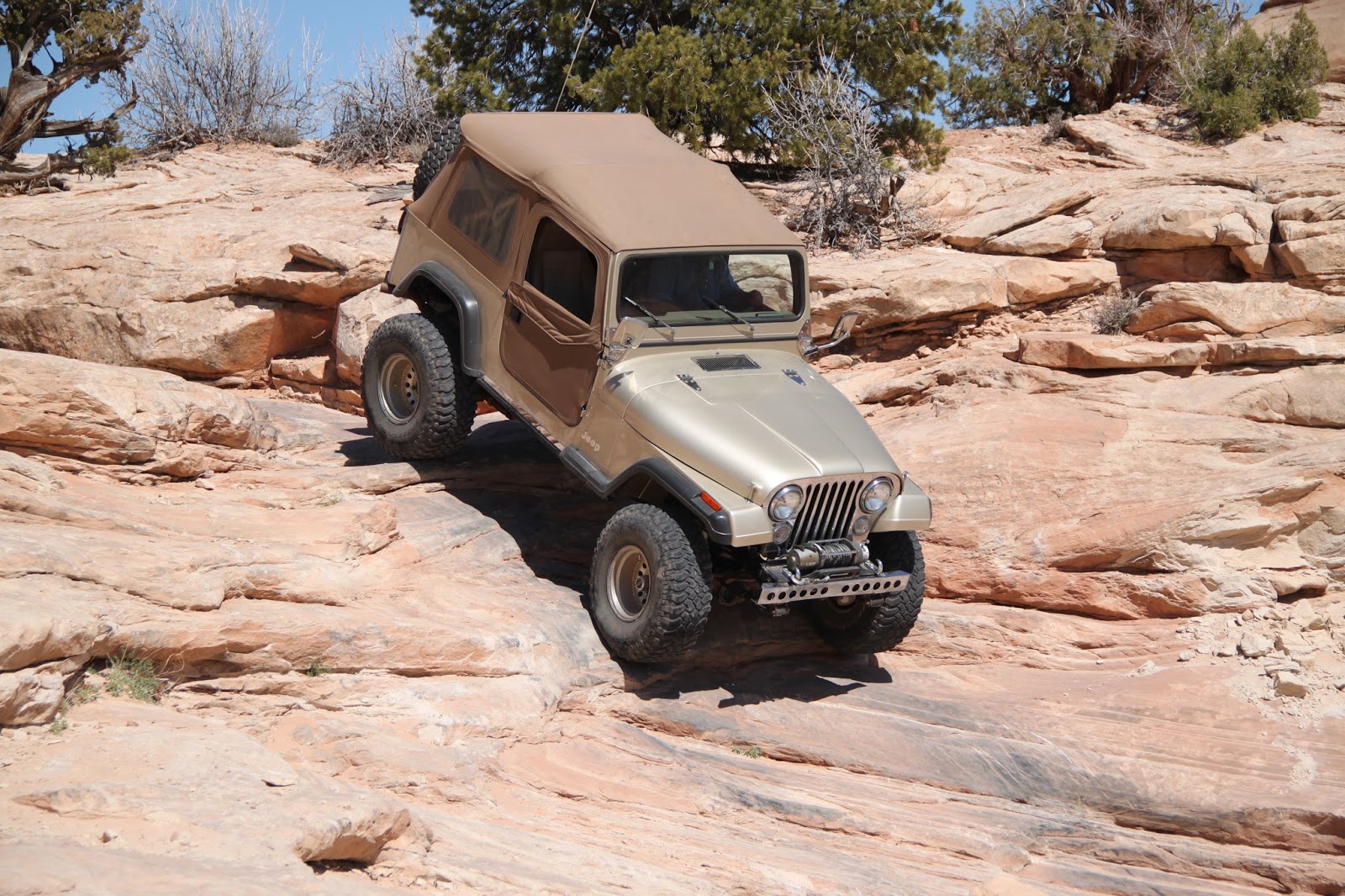
 |
| Mike crossing what he calls "the Silver Crack". |
Mid to late March in Moab can be
slightly “iffy” as far as the weather is concerned. Cold nights (lower to upper 20s) and warm
days (upper 30s to lower 60s) make for some “cozy” camping conditions and
excellent “on the trail” days.
Still recovering from open heart
surgery, I was under Doctor’s strict orders not to lift any more than about 10
pounds which precluded me from even packing my tent cot in the back of Happy
Trails (my ’06 Jeep Rubicon), so I was limited on how much “camping” I was up
to.
 |
| Here's Roy flexing his CJ on the "Silver Crack". |
Add to that the fact that getting
cold was not an option… shivering with a still healing chest is more than just
painful.
The weatherman had been saying all
week that Sunday would be “the day” to be out, so Sunday it was. The trip planned for the day was one I had
not done before, so everything was working out perfectly.
 |
| Flexing to the point of unloading a coil spring. |
The Sevenmile Rim Trail is rated as
“Difficult” in Charles Wells’ “Guide To Moab, UT – Backroads & 4-Wheel
Drive Trails” book.
 |
| Happy Trails stretching on the "Silver Crack". |
With sights like Uranium Arch,
Monitor and Merrimac Buttes, overlooks of Arches National Park, the snow capped
La Sal Mountains, and Determination Towers to look forward to, this day
promised to be legendary.
The notorious obstacle “Wipe Out
Hill” along the trail was a major draw as well.
Having heard many stories of success and failures on this famous Moab
obstacle brings a quickening to your heart rate if you’re into Jeeping in a big
way. These famed Moab obstacles don’t
come by their reputations lightly.
Leaving Grand Junction at about 6
AM meant driving I-70 in the dark. That
proved to be a blessing in a way.
Extreme eastern Utah along the interstate can be pretty boring. The silt left behind from the prehistoric seas
apparently has little to offer plant life, not even sagebrush will grow there.
The sun was just breaking the
horizon as we were passing the Hwy 191/313 intersection where we were to meet
later. Gas and a small breakfast were
awaiting us in Moab.
 |
| Lined up and ready to go. |
Returning to just north of the 313
junction, I patiently awaited the rest of the troops. I spotted a Jeep that looked like Roy’s CJ go
by and then Cody Lange turned in to tell me we would be assembling at the 313
intersection as mentioned in the trip preliminary.
By the time we got to the assembly
area, most of the day’s trail seekers were already lined up and ready to hit
the trail. Mike Ehlers was to become our
trip leader and we followed him a short distance up Hwy 191 to the turnoff.
The actual trailhead is well marked
by a metal sign some distance from the highway turnoff. From here, the trail begins getting rough and
rocky.
 |
| Climbing the mesa on the Sevenmile Rim Trail. |
A fairly steep grade becomes ledgy
as you change altitude and pass through different layers of sandstone
strata. Some of the more difficult ledges
have by-pass opportunities if you choose to use them. Most of us didn’t.
 |
| Ascending the Sevenmile Rim Trail. |
The views to the east get more
dramatic as you ascend the mesa to the south.
Unfortunately, there was a haze that spoiled our views looking into the eastern sunlight… blurring our views of Arches National Park and the magnificently
snow capped La Sal Mountain range.
Not long after reaching the top, we
stopped to “play” on some tall slickrock ledges just off the trail. It was here that I left a large piece of my
previously broken left front fender flare hanging in a Juniper Tree as we
passed by a little too close. A set of
Bushwacker flat fender flares have been on the agenda all winter… now they
seemed a lot more important.
 |
| "Playing" on ledges just off the trail. |
The new flares require the Jeep
body temperature to be above 60 degrees for the double-sided tape to adhere
properly, so we’ve been waiting for warmer days to order them.
 |
| LJs nearly dragged the belly on these steps. |
The next few miles of the trail
weaves near and away from the east rim where views of Hwy 191 traffic below
look like small matchbox cars. Further
east is Arches National Park. Some
arches were vaguely visible through the haze.
A little to the south shown the La
Sal mountains with their white crests gleaming through the haze. On a clear day, this would make for some
great “Kodak moments”.
 |
| Luke found this to be "as far as you go" on these ledges. |
Not too far along we passed the first
road to Uranium Arch. Trip leader Mike
was looking for another road to it and left us setting beside a second road to
the arch while he searched for a painted rock.
Not finding the painted rock, he returned to the group and took us down
into Uranium arch where we held a lunch break and did some exploring on foot.
 |
| Roy hitting the "Automatic Reject Feature" button. |
Arches are phenomenons that always
seem to hold one in awe. When you stand
under or on one, you just can’t help wondering how they form and how long they
will exist before crumbling into a heap of broken rock.
 |
| Uranium Arch from below. |
How awesome it would be if one
could live long enough to watch one form… though you might want another
interest or you could become quite bored after a few thousand years of watching
sandstone wear away.
 |
| Uranium Arch from above. |
After driving further south for a
while, the trail arcs to the west toward Monitor and Merrimac Buttes far in the
distance.
 |
| Happy Trails about to lose the front fender flare to the tree. |
Approaching the buttes gives a new
perspective of the sizes of these monoliths.
From seemingly nowhere, these two giant sandstone mountains with
vertical cliffs hundreds of feet tall just jut from the earth.
Eons of weathering are evident as
you get closer. This makes you wonder
how long they have existed and how they came to be there. (must have been one large jack that raised
them from the earth below)
 |
| Cody making ledges look easy. |
After passing between the buttes,
we encountered some off-camber trail and a narrow passage between the “rock and a hard
place”… literally. Your outside mirrors
are in peril as you maneuver through at about 25 mph. (yeah, right)
Not too far from the narrow spot,
the trail takes a few turns leading to a steep side-hill of slick rock.
 |
| Crossing the off-camber slickrock. |
Here, you must climb a steep slickrock
approach that leads to a looong arc crossing a very off-camber slickrock
side-hill that LOOKS much worse than
it seems as you drive its length.
 |
| Roy climbing to the off-camber slickrock arc. |
At the far end of the severe
off-camber, you drop down a very steep slickrock grade to the sandy trail
below. Not far from here is one of the
very famous Moab obstacles… Wipe Out Hill.
 |
| Cody descending the slickrock hill. |
When going to Moab, there are
certain obstacles that stand out by reputation.
Wipe Out Hill is one of these.
 |
| Mike descending Wipe Out Hill. |
Going down is plenty rough on the
seat covers as you feel like you’re standing almost vertically on the
hillside. Your tires will chirp in
places as you attempt to slow your descent.
Yeah, it’s steep.
At the bottom is a small flat where
you must turn around and get a new view of how much trouble you just got
yourself into. There are a couple of
lines you can take to extricate yourself from this pit. One very steep slickrock track and one
extreme, loose rock shelf that only the large tire guys can run.
 |
| Roy climbing Wipe Out Hill. |
 |
| Roy descending Wipe Out Hill. |
After watching others in our group
make the descent and then ascend the hill with no trouble, I pointed Happy
Trails down the trail… turned around, engaged the ARB lockers and proceeded toward
the top.
 |
| Happy Trails on Wipe Out Hill. |
Just feet from the top, I felt the
front totally unload. I was inches too
far to the right. We scared the
bystanders really bad by the looks they all had on their faces as we backed
down for another try.
With all the weight I carry on the
rear bumper and tire carrier, (two 5-gallon fuel tanks, full-size spare, high
lift jack, axe, shovel, and rack, plus tools and recovery gear inside), the front gets a little light in situations
like this. You get to know when to say
“when” quickly under these circumstances.
 |
| Happy Trails getting light in the front. |
Mike came down the hill yelling for
me to have a strap attached to the front that three or four guys could help
keep the front earth bound… so we did.
The second attempt to climb Wipe
Out Hill was much more successful. The
right line made a lot of difference and we nearly over ran the strap gang. Check off another challenging Moab obstacle as accomplished.
Returning to the trail, we found
ourselves running a dry wash that suddenly turned wet. It was like the Beverly Hillbillies… only
water, not oil. A spring bubbled from
seemingly nowhere and began running down the wash. Dust was no longer a problem for quite a
distance.
 |
| Luke on a tough rocky ledge. |
Nearing Determination Towers, we
left the wet wash bottom and proceeded north to a junction with Mill Canyon
Road. Here you turn east which brings
you back to Highway 191.
 |
| Determination Towers on Sevenmile Rim Trail. |
The day of Jeeping concluded, most
aired up for the long trip to Grand Junction.
Some still had to go back and “break camp” while others of us just
turned onto the highway and headed home with a wide smile on our faces.
 |
| End of the Sevenmile Rim Trail. |
This would be another of those
trips you ingrain on your memory. Good
friends, great weather, and a superb Jeep trail. It just doesn’t get much better than this!
One last thought; “When you come to
a fork in the road… take it!”
Happy trails.
Copyright: Happy Trails 4wd – 2017. All rights reserved.
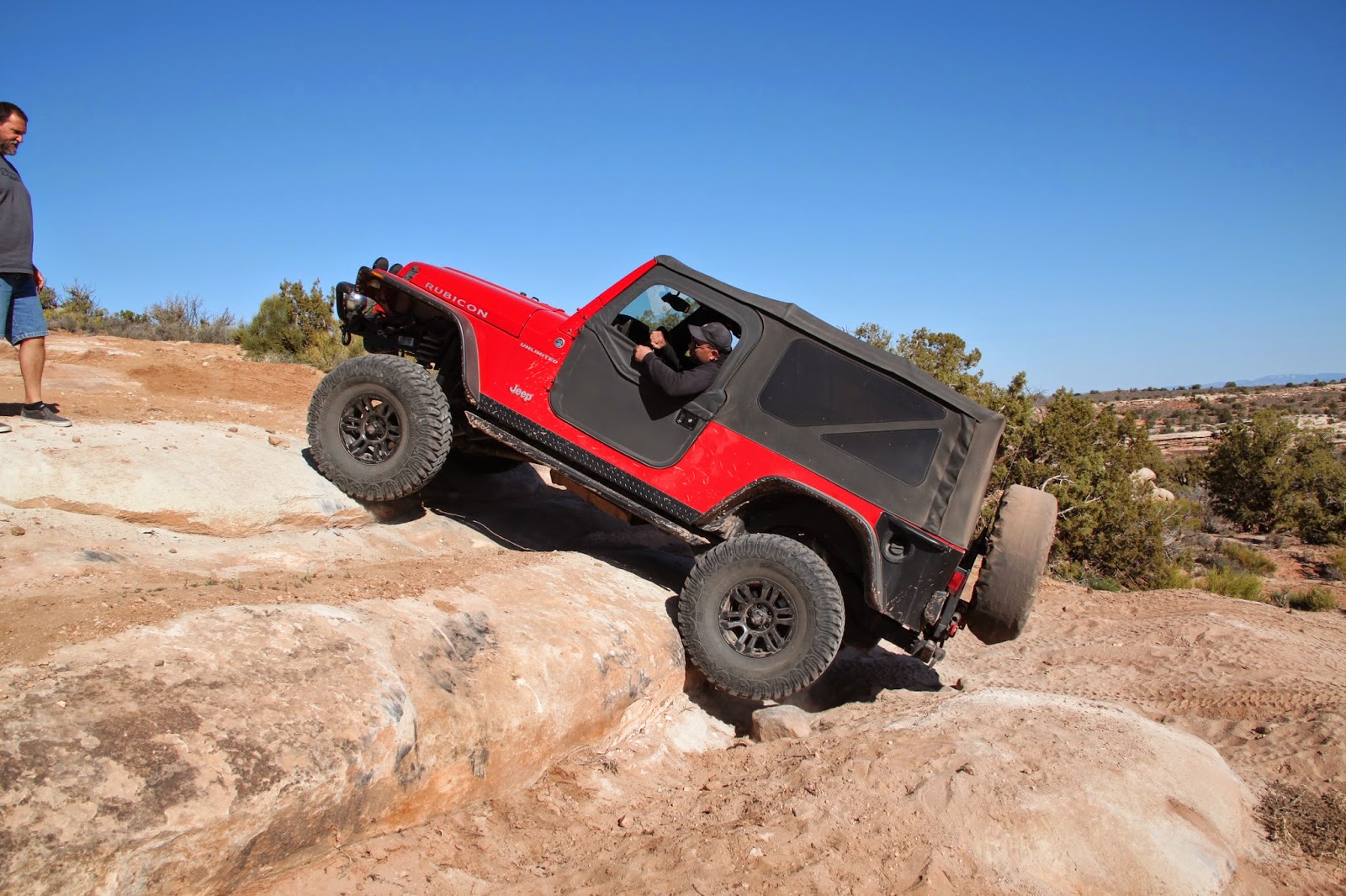
More photos for your perusal.

More photos for your perusal.
 |
| Finding rocks isn't much of a job on the Sevenmile Rim Trail
-------------------------------------------------------------------
       |


No comments:
Post a Comment