Showing posts with label Gateway. Show all posts

Saturday, July 15, 2017

Adventure at the COAFWDC Meeting

Adventure at the COAFWDC Meeting

By Jerry Smith


For those of you who did not attend the 2017 3rd Quarterly meeting of the Colorado Association of Four Wheel Drive Clubs, you missed what might have been the meeting of the century.

The meeting was to be an “on the trail” event on Calamity Mesa near Gateway, Colorado.  The agenda was to hold the meeting on the trail, then camp over night with the possibility of an evening trip on one of the shorter trails.  Sunday, we would break camp and then run the Calamity Mesa Loop Trail.

Lower "Gatekeeper"

The attendees who showed up met in Grand Junction as instructed and proceeded to the 6.3 Road turn off on Hwy 141.  The day was a hot one.  With no signs of any other attendees, a corporate decision was made to drive into Gateway and meet in an air-conditioned room at the Gateway Canyons Resort.

Due to no quorum being present, the meeting was short and productive for what little business could be done.  After the conclusion of our quick meeting, it was decided that Brian and Larry would begin their journey home while Jerry and Ige would go to the original meeting place just to make sure no one was waiting there.  Ige had never been in this part of the world and wished to become acquainted.  I told her that it would be about 40-miles of extra driving, but she insisted on going.

The 6.3 Road, aka the Niche Road, was its usual looonnng, steep, ascent to the top of the lower Uncompahgre Plateau.  It averages to be a 15% grade for about 6-miles.  The road was still in very good condition from its last grading and we made good time getting to the original meeting place.

After some exploration of the New Verde Mine that Ige had never seen before, a slow rain began with large raindrops falling.  The drops were much cooler than the air temperature and the ambient temperature began to drop.  As we departed, the rain began increasing in intensity.  Soon a sandy mud was being flung from the tires and the windshield wipers were working overtime.

The New Verde Uranium Mine  

The rain kept increasing and then it began turning to hail.  The noise on the hard top became deafening, but we pressed on.  Upon reaching the turkey foot intersection at the top of the steep shelf road, I shifted into low range to control the speed of descent without riding the brakes.

Small rivers of swift moving water were already eroding the road surface and the sides of the road as the water cut deep into the lower side and dropped into Ute Creek.  The road was slick and steep with little stopping power.  Several large rocks were rolling into the road from the high bank adding to the danger. 

The lower side of the Niche Road was washing away along the whole road.


Thoughts of what the wash/road would be like by the time we hit the bottom were alarming.  The lower road is literally the wash.  Most of the time, the road is graded and in good condition.  Only about an hour ago, it was in typical condition.  Judging by the deteriorating upper road and the volume of water increasing exponentially, the term “flash flood” seemed more likely.

About ¾ of the way down the mesa, Ige lost all signs of air pressure in the right front tire.  I was ahead and out of sight but noticed there was no one following and pulled up to wait.  After a minute, I turned around and headed back up.  Ige was already soaked and had the spare out.  Within seconds, I was soaked as well.  We got the tire changed and Ige lead of down the hill.

Where the steep road meets the wash, it was no surprise to see a river of rushing water charging across the road.  Not knowing the depth, Ige allowed Happy Trails and me to “Jeep the creek” first.  The water was near the top of my 35” tires in the deepest place.  Now we had much to be nervous about.  That much swift moving water and a sandy wash bottom could be a BIG problem. 

As we approached the wash/road, this is what we found. 

After a short way, we dove back into the raging water.  Some places, the surf was definitely UP!!  Others, it was just a wide riffle with occasional holes and large rocks.  The corners, of which there are many, were where the real damage was being done. 

Ige entering the first of the flood waters.
Leading the way, I tried to read the water and avoid the deep holes and larger rocks.  Ige tried to follow in my tracks that were invisible.  Several times, I waited to make sure she was able to make it through some difficult places.

In places, choosing a line was difficult.
Near the bottom of the road where the normal air down/up ceremony takes place, the road had disappeared.  Now there was a vertical bank with a narrow access to the road above.  Just recognizing the road was difficult, but we made the right choice.

When we stopped at the wide air-down area, the first thing Ige asked was — “Were you trying to kill me?”  What should have been a simple trip up the side of the mesa had turned into an adventure that most will never experience.  All I could say was – “I told you it would be 40-miles of extra driving.” and “that going out with Jerry can be dangerous.”  Other Grand Mesa Jeep Club members can vouch for that.

After disengaging the hubs and a little talk, we departed for home(s).


The grizzly rock screen is now about 75 yards down stream.

Just an hour before, there was a grizzly rock screen setting there.


Thursday, March 23, 2017

Delores Point / South Beaver Mesa

By Jerry Smith


March 22, 2017, the team of Tom/Connie and Jerry struck out for the Delores Point and South Beaver Mesa trails.  These trails are in the neighborhood of Gateway, CO.

After a quick stop in Gateway, we proceeded up the John Brown Road through John Brown Canyon.  It is a steep grade up a well-maintained county road through a deep and narrow red canyon.   

The Gateway Canyons Resort from Delores Point

After passing the Whirlwind Uranium mine, we proceeded out the Delores Point Mesa to GPS the routes that would be run for Rock Junction 2017.  Rock Junction is the Grand Mesa Jeep Club’s annual three-day trail event held the three days before the first Saturday in June.  That day is reserved for the Rocky Mountain Off Road Expo.

Up until we turned and started along the east rim of the mesa, all was good.  The rim section has severely overgrown trees reaching out well into the trail.  This slowed progress to a crawl and was very noisy as the branches screeched across the paint and top.  This will require several hours of trimming before we can offer this trail to our guests.

The Grand Mesa Jeep Club must annually pre-run no less than five trails before Rock Junction.  Winters and Spring can be very hard on many area trails.  Downed trees, rock falls, overgrown brush, and erosion can 
put a trail out of commission until we come along with the necessary maintenance.  Our guests come to drive the trails, not to do maintenance.
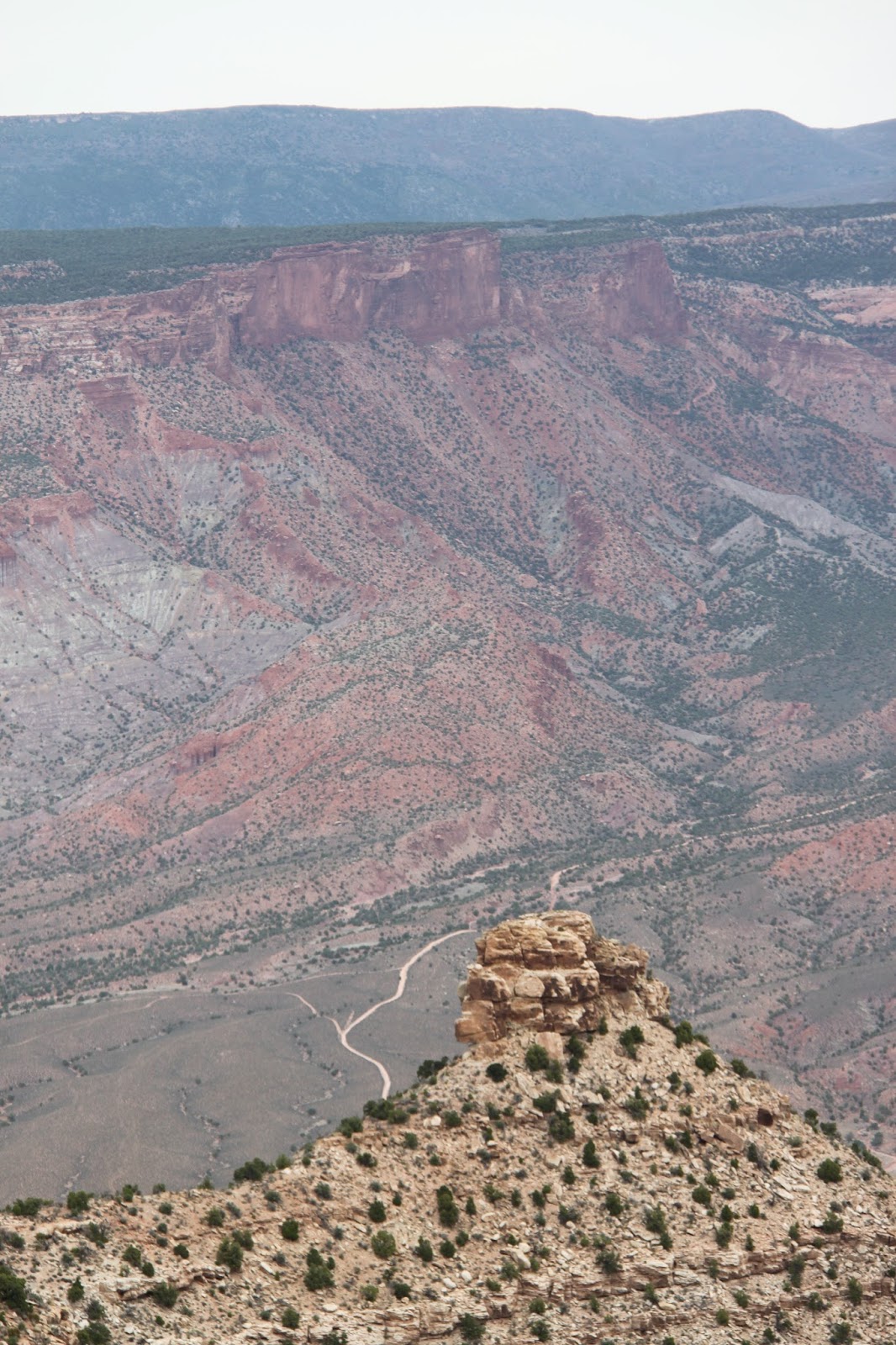
This is the Sheep Creek Trail.  The road easily seen in the bottom winds its way to just below the vertical cliffs at the top of the picture.  This narrow, steep shelf road can be a challenge in the spring due to erosion and rock falls.

 As it was, we picked up a hefty gunny sack full of cans and bottles along the trail and winched a large fallen tree from the trail.

The grand highlight of this trail comes at the end.  The views of the surrounding countryside are to die for.  Spectacular scenery greets your eyes in every direction.  If you are remotely familiar with the area, you will recognize many landmarks.

We could point out the Delores Overlook and the newly christened “Top II” trail where we had driven last Sunday.  Top II is the southern end of the up thrust mesa that graces the Top of the World trail of Moab fame.  From some viewpoints on Top II, you can see the terminus of Top of the World like nowhere else.

These spectacles from Delores Point made our lunches much more enjoyable.  Other trails seen from there include Sheep Creek, South and North Beaver Mesas, Polar Mesa, and the region around Rose Garden Hill.

Returning back from Delores Point, we continued to the South Beaver Mesa turn-off.  The South Beaver road starts out fairly mild and scenic.  But once you reach the hairpin turn, hold on to your seat --- tightly!!

Tom climbing the South Beaver Mesa trail.  Notice the severe erosion.

 From here, if you don’t like steep, narrow, loose rock, washed out with 2-foot deep channels, class 7 or 7+ shelf roads, now is a good time to just park and enjoy the scenery.  For the next mile or so, you WILL be paying close attention to your driving.

Off-camber, steep, and full of loose rock and sand, this trail WILL make you pay attention to your driving.  The scenery is over the top as well, IF you take a moment to notice.

 At the bottom of the steep part, there is an old shack and dugout cowboys or shepherds used -- we think.  It is set on the rim of the Beaver Creek Gorge in a beautiful setting.  In the dugout, you can still find bottled water and a can of Campbell’s Chicken Noodle soup that have been on the shelf for at least 7-years.

Stocked shelves in the Great American BackCountry are a rare find.

This is the "cow camp".  The small shed has a bunk bed while the dugout is stocked with bottled water and a can of soup.  A corral is to the right of the gate.
The dugout had a wood stove and bed springs for a short man.  Crutches still hang on the wall.


The road continues out So. Beaver Mesa, but is not very exciting as Jeep trails go.  So we began the slow, rough and rocky climb back out.

The trail is littered with fallen and erosion exposed rocks of varying size.

 At an intersection, we turned off the trail onto another faint road that brought us to another cabin and dugout.  This one was built mostly from area Juniper.  This is an unusual building material for a cabin.

Cabins built of Utah Juniper are rare finds.  That is cactus growing on the roof.

The dugout is also Juniper and a sod roof with cactus growing on it.  This would have been a pretty cozy place on a cold night.

The road continued in the general direction of the Gateway to Moab road, so we crawled along hoping it would take us all the way through.  Following my nose has often resulted in good things happening, and after quite a long time, we came to a familiar road that took us out to the road back to Gateway.

A herd of Mule Deer allowed a quick photo.

 Another superior day in the Great American BackCountry and another reminder of why I live by Yogi Berra’s “Yogi-ism”;  “When you come to a fork in the road, take it!”  That is where the adventure begins.


Copyright Happy Trails 4wd, 2017.  All rights reserved.

Sunday, April 6, 2014

The Granite Creek Trail

The Granite Creek Trail

In the Lower Delores River Drainage

By Jerry Smith

April 5, 2014

The Granite Creek trail is one that has had little use by full-size vehicles for several years.  Gamble Oak and Juniper trees had grown into the trail leaving little room for full-size vehicle access.  Even the overhead is grown over in places.

The Granite Creek trail takes you through some spectacular Colorado and Utah Canyon Country.  Deep within the canyon, one has no idea when you cross from one state to the other unless you closely watch your GPS.  That requires a great deal of concentration as the scenic values of this deep canyon and the trail keep your eyes quite busy.

For years, the Grand Mesa Jeep Club (Colorado's Club of the Year - 2013) has been discussing this as an opportunity for a “club project”.  Reopening trails closed by Mother Nature has been an annual endeavor by a few club members.  Last year they reopened the Coon Hollow Jeep Trail after Mom Nature had physically closed it for years.

Shortly after the 8 AM meeting time, we struck out for adventure with a side dish of work from the Albertson’s on Broadway in Grand Junction, CO.  In no time we were weaving our way through the east entrance to the Colorado National Monument.  What a way to open your sleepy eyes on a cool Saturday morning.

Passing through Glade Park, we picked up the last member of our group – totaling 11- vehicles.  A great turnout considering we intended to begin what was billed as a two-day work project.

Roy proved to be "the workhorse" on this trip
At the Colorado/Utah border, those who desired to do so, aired down.  Most members elected not to drop air pressure for the short roughly thirty-mile drive to Granite Creek.  Some lived to regret that decision.

The road along this route is generally rated easy and recommended for stock vehicles.  Last fall, we encountered more difficulty than would be normally expected on our way to Gateway, CO.  Snow has a way of increasing the difficulty of many trails.

Melting snow and slick mud made this hill a challenge for all

This early in the spring, some snow and mud was anticipated in the higher elevations of upper Granite Creek.  That would only add to the “fun” in achieving our destination… until we learned that Jason’s Grand Cherokee was without a front driveline for the day.

One rocky hill climb proved to be too much for the 2wd vehicle and Roy came to the rescue with a tow strap.  Then we crossed upper Granite Creek and encountered a steep, rocky, muddy, and melting snow covered hillside.

Jason again hit the “automatic reject feature” button and required a tow from Roy.  It took several tries to find a line to get them up the greasy hill, but Roy made it look easy once enough traction was found.

The next one to find that same reject button was Collin in his carbureted CJ.  The incline caused the engine to cough and sputter to a halt mid-way up the hill.  Once again Roy came to the rescue.

Lost Horse canyon has some awesome scenic values as well
Not long thereafter, we turned off the main trail and entered Lost Horse canyon.  After a few miles, this canyon intersects with the main Granite Creek canyon and proceeds westerly. 

After entering Granite Creek, there were many stops for brush trimming parties.  Several trimming tools and a chainsaw were put to good use for the next few miles.  Gambel Oak and Juniper trees were trimmed back to allow for full-size vehicles to pass without fear of losing paint to the stiff branches.

Hoo Doos and arches adorn the Granite Cr. canyon rim
Last fall, on another trip to the region, several club members had walked down from the top of a steep, really rocky and narrow shelf road that drops you into Granite Cr.  They reported one rock protruding from the upper hillside that barely left room for Luke’s narrow CJ to pass by.

The rest of the trail was said to be grossly rocky, dangerously narrow in places, and quite steep.  It sounded like my kind of trail.

Upon reaching what Harley refers to as “the Homestead”, we could see the steep shelf road along the side of a steep box canyon.  This would be the end of the brush trimming for the trip.  We had done in a day what had been predicted to be a two-day project… so far!

After exploring the “Homestead”, we began ascending the lower tight switchbacks to the shelf road visible from below.  Once above the switchbacks, the road became even more narrow and very much more rocky.

Ascending the the tight switchbacks to the shelf road exit
Many of the rocks were of the size a small-tired vehicle must totally avoid.  Some caused a terrific view from the passenger side of the box canyon on the lower side of the road as the outside tires searched for something to hang on to.

To give an additional understanding of the word “steep” when describing this section of the trail, Collin’s CJ stalled again requiring Roy to back several hundred yards to provide assistance.  Roy certainly proved to be a major asset to this trip.

The narrow shelf road crawls a steep cliffside
Having attained the mesa top, we found that we had used up the majority of sunlight for the day.  No time was squandered getting back to the end of DS road at the CO/UT border where we aired up and split up into smaller groups for the drive back to town.

We offer many thanks to all participants for all their patience, cooperation, and hard work in reopening another trail.  To some, new experiences with using a tow strap and brush trimming tools were a source of learning.

The Grand Mesa Jeep Club ascending the shelf road on Granite Cr.
Reopening a trail is a joy that not many of the wheeling community have experience with.  Yes, it can be a lot of work, but it is done with the knowledge that the worker and many others will be able to enjoy these trails well into the future… barring any land managers and “Preservationists” getting in the way.

This box canyon is what you avoid while climbing the shelf road
This day was loaded with learning and working experiences for all.  It also provided for a great day of Jeeping that our memories will hang on to for a long, long time.

Hopefully, the Granite Creek trail will remain open to excite many seeking an adventure in a wonderful part of the great American BackCountry.

Note the narrowness of the road near the JK.  You get a dandy view there!
One last thought you should remember; “When you come to a fork in the road… take it!”

Happy trails.

Copyright:  Happy Trails 4wd – 2017.  All rights reserved.
Looking back down at the "Homestead"
This is a rocky trail
Steep and narrow, but oh so beautiful

Winding along the narrow shelf road