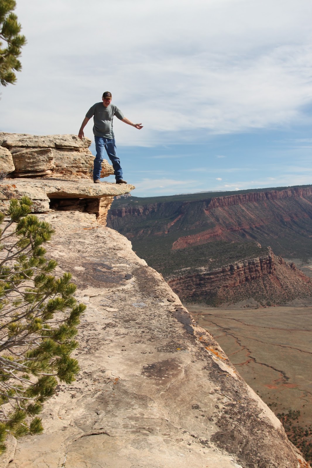
Showing posts with label Western Colorado Trails. Show all posts

Monday, May 22, 2017

The Calamity Mesa Loop - 2017

The Calamity Mesa Loop - 2017

by Jerry Smith


Calamity Mesa is in a remote part of western Colorado near the little town of Gateway.  This one hitch post town has a small school, a volunteer fire station, and one convenience store that dominates town business unless you count the expensive Gateway Canyons Resort.

Calamity Mesa has a rich history.  Most of the riches revolve around the uranium found deep in the ground, but other riches can be found on the surface.

From the mesa top, some of the views are like nowhere else. On a clear day to the south, the San Juan Mountains and Lone Cone Mountain stand covered with bright white snow.  Shift your eyes to the west and the Sewemup Mesa Wilderness Study Area will dominate your view.

Lone Cone Mountain is about 50-miles south


With no mention of under what conditions, this warning is for the road to Calamity Mesa.

Sewemup (Sew-em-up) Mesa has a rich history of its own.  Cattle rustlers once took their stolen herds into Sinbad Valley where they surgically removed the brands, sew-em-uped the wound, and later rebranded the animal.

Above Sewemup Mesa are the snowy tops of the La Sal Mountains.  Just to the right of Sewemup, the Salt Creek canyon winds its way up into Sinbad Valley.  Below your feet at the “lunch with a view”, the dark red Blue Creek Gorge dumps its stream into the larger Delores River. 

The La Sal Mountains have an anomaly in the spring.  A giant shark with his mouth open faces east.
To the north, there is Cone Mountain and the Sky Mesa Ranch.  Then Flat Top Mesa and Tenderfoot Mesa melt into Maverick Mesa. 

Saturday and Sunday, May 20&21, Calamity Mesa saw several of the Grand Mesa Jeep Club in trail maintenance mode.  Saturday we ran the Calamity Airstrip trail and the last 2/3s of the big loop.  Sunday, the entire Calamity Mesa Loop was run.

This is the confluence of Blue Creek and the Delores River
There are three major trails on Calamity Mesa.  The Calamity Mesa Loop is about a 19-mile loop with 12-named obstacles.  The Airstrip trail is on the mesa top where the views are incredible.  The third loop is a shorter loop with a small mining camp still standing.

The Calamity Mesa Loop was closed by Mother Nature for a minimum of 25 years… long enough for a Pinyon Pine to grow to about 5” at the butt in the middle of the road with no room to go around.

The Airstrip trail received limited brush cutting but will require more in the future.  Some of the oak brush that once covered the road has begun to regrow.  The day was near perfect for sightseeing with all the rain and snow we’d had.  The air was mostly clear and the San Juan Mountains and Lone Cone were looking cold in their white top hats.  The same could be said of the La Sal Mountains.

The Airstrip trail is reverting to an oak brush forest.
Saturday was largely uneventful compared to the Sunday trip.  Sunday began like any normal Jeep trip, but that didn’t last long.

Upon reaching the Gatekeeper obstacle, it was obvious that this winter had been very tough on the trail.  Serious erosion and the havoc it causes was apparent right from the start.  That is nothing new on Calamity Mesa. 

Many question the sanity of entering the Gatekeeper Wash
But when the trip leader sets off to show the rest of the group the line going down the rocky wash only to become stuck on the two large rocks in the bottom of the wash, things deteriorate.  When the rear axle rubbed on the rocks, rear axle traction became substantially reduced --- in two-wheel drive. 

Jumping out to assess the problem, I noticed there were no scratch marks under the front tires like there should have been.  Having been in 4-low, that meant the front wasn’t assisting the rear.  A quick turn on the front hubs and we pulled right up on the road.  Not much of a “stuck” compared with what was to come.

With the Gatekeeper behind us, the “Narrows” is the immediate next obstacle.  The wash that makes up the Gatekeeper continues down along the right side of the trail in a deep ditch with very steep sides.  This ditch cuts through a bentonite ridge and the trail has eroded away to barely the width of the average Jeep.  Bentonite is slick when dry.  When wet, forget it!!

The left side of the road is a steep bentonite hillside that one does not want to slip off onto and the narrow trail is crowned so much, a small-tired rig leaves an imprint where the differential drags.  One error in driving, either way, WILL result in a rollover.  We all made it safely across “The Narrows”. 

Further down the trail, we came to “Gyration Wash”.  Here again, serious erosion had changed the character of the obstacle.  At the beginning of the obstacle, you cross a deep wash diagonally that will require some serious articulation.  The water had cut a new, deep channel parallel to a fallen tree in the narrow wash bottom next to a steep off-camber stretch of trail.  Going into that new channel would have been bad and the traction on the off-camber trail tended to slide you toward it.

Once past that part of the obstacle, large rocks greet you in the wash.  In years past, that ended in a rocky waterfall with about a two-foot drop.  Some of the rocks were now further down the trail leaving a new obstacle to learn.  With a little spotting, everyone got through unscathed.

The next few miles have been relatively easy in the past.  Today, there were some new rockfalls that eventually got one of our group in trouble.  The first three vehicles were able to sneak around a large rock in the middle of the trail. Number four… not so much.  The “sneak” required you to get dangerously close to the lower side of the trail. 

Upon returning to the scene of the accident, it was clear that the people planning the extraction with a tow strap were about to make the situation worse, so we moved on to plan-B. 

After pointing Happy Trails toward a tree up the uphill, we ran the winch line through a snatch block and back to the Jeep off the side of the road.  With minimum trouble, we were back on the trail and headed for the “lunch-with-a-view”.

After the lunch, we made our way to some of the more difficult obstacles.  Most went well, but then we got to “Hogback”.  The entrance to Hogback has changed dramatically.  The wash that cuts diagonally across the trail is much deeper and ugly looking.  We all managed to get through the crossing and upon the rocky, narrow Hog’s back. 

"Rocket Man" showing why the name
"Hogback" with some showing off


Some did it with a little show by lifting the right front tire.  Then came “Rocket Man” in his white TJ.  His right front got some significant air time.

Once upon the top, your line choosing is critical or you become “turtled” very easily.  All the Jeeps managed to negotiate the tough obstacle just fine.  The FJ Cruiser with its typical limited articulation slipped off of one of the rocks and went laterally to the driver’s side.  So the second winch line came out to save the day.

Proper line choosing is critical on "Hogback"
In all fairness to the FJ, a Jeep had the same “calamity” on Saturday.  A short winch pull later he was on his way.  We hated to use the pristine wound virgin winch cable, but that's what a winch is for.

We broke in the winch and recovered the FJ
It’s been a long time since we needed to pull cable on the Calamity Mesa Loop.  Maybe we have been doing it all wrong.  Sometimes a little erosion can be a Jeepers friend.

Our next problem came at the “Overnight Wash” obstacle.  In past years, this wash has been a major problem.  Literal tons of rocks have been placed in the lower wash to keep the trail passable.  Every couple of years, more rocks are needed as they get washed downstream.  Some of those rocks have weighed hundreds of pounds and required a winch to move them.

The crew moved several new rocks from the upper wash into the lower wash to both slow the water and to beef up the lower bank of the road.  The roadside was becoming unstable and dangerous.  We like a difficult trail but draw the line at dangerous.

The next obstacle is “Tippy Rock”.  It’s a fairly large rock in the middle of the trail.  Over the years, people have stacked rocks to make it easier to crawl over.  The first few years, you had to go up around the rock on the high-side requiring an extreme off-camber condition.

Some took the rock and others went around.  Then came the FJ again.  We thought it would crawl the rock with no trouble, but that was poor planning.  But after a couple of false tries, the FJ showed we were right.
"Tippy Rock makes a suspension work hard

Getting on "Tippy Rock" is easy, getting off... not so much
The last of the named obstacles is “The Squeeze”.  On the very side of the trail is an old Utah Juniper tree.  In the middle of the road is a substantial rock/boulder.  The distance between them just barely allows a JK width vehicle passage. (We do NOT allow full-size vehicles on this trail)

"The Squeeze" leaves little room for error
There are other obstacles and some narrow shelf road to negotiate along the trail.  Some of the shelf road has caused some to get out and walk. 

If a 19-mile loop road with some significant obstacles along the way sounds like your kind of trail, get signed up for the annual Grand Mesa Jeep Club’s “Rock Junction” event.  We have this and a couple other trails that are right on your “wanted” list.

One last thing needs to be addressed.  Yogi Berra said it first, but any GREAT Jeeper lives it;  “When you come to a fork in the road… take it!”  That is where adventure often awaits.
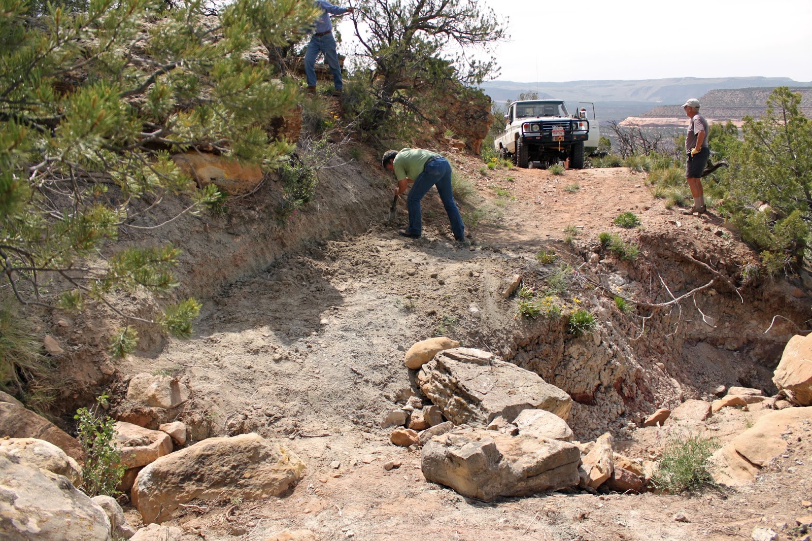
Widening the trail has been necessary more than once

This is another look at "Overnight Wash" from long ago

Note the large rocks on the right.  They have washed away.


This is the stump of the tree in the middle of the road when we reopened the Calamity Mesa Loop
"Mike's Rock" will take mirrors or paint if you're not careful

Happy Trails on "Twisted Drop"


Monday, March 20, 2017

Delores Overlook and Others

By Jerry Smith


Yesterday, March 19, 2017, the majority of Grand Mesa Jeep Club participants headed for the Top of the World Jeep trail of Moab fame. Thirteen rigs left Fruita and assembled at the Dewey Bridge turn-off to air down. A 14th joined us there. Several other rigs passed by on their way to the same destination as trail preparations were made.


The Delores River from Delores Overlook

I had already informed trip leader Todd that I would not be doing Top of the World but would follow them to the trailhead, as that was on my way to the Delores Overlook trail and other area trails. Just before leaving the staging area, Tom asked if I would like some company, so Tom and Connie tagged along on one of my many exploration forays into the Great American BackCountry.

The short trip to the trailhead was one of severe dust. Judging by the way the thick, yellowish cloud hung in the air over the freshly bladed road, wind, or lack of it, would be a problem today. The line of intelligent Jeepers became strung out over great distances, the others, well… let’s just say they will need a new air cleaner.

The Delores River from Delores Overlook

As Tom and I passed the others, it was clear that their dust problems would be greatly lessened because their trail speed would be cut by about twenty miles per hour. The Red Rock 4-Wheelers rate the Top of the World trail as a 6 in their Easter Jeep Safari paper. When you drive the upper loop in a clockwise direction, you may think you’re on a 7 or 7+.

We, on the other hand, continued on the Entrada Road creating billowing clouds of choking dust. Except when stopping to pick up some O.P.T., I seldom saw Tom in the mirror. (O.P.T. is; Other People’s Trash). We did communicate on the CB so that there was some idea of where the other was.

The Sleeping Camel

Around 13-miles into the trip, we came to the first of two 4-way intersections. Continuing straight would eventually take you to the famous Rose Garden Hill. I had already descended Rose Garden twice this year. As obstacles go in the last few years, Rose Garden has gone from difficult to extremely difficult. On the first trip DOWN this year, we had to winch one vehicle that became hung up on a ledge. With the large rocks and ledges and all the loose rock and sand, ascending Rose Garden looks to be close to a Hammers type obstacle. You get a good mental and physical workout going DOWN.


The road to the left would take us out to the Delores River Overlook. This is a trail with some light challenges at first. Once you reach the mesa top below, the trail almost challenges you to see how fast you can drive.

The “overlook” is a spectacular vision. You are standing at the intersection of the Delores River and Cottonwood Canyon, only hundreds of feet above this eye feast. Today, the river was running a chocolate color liquid that contrasted with the red and cream colored cliffs reaching skyward from the milky waters.

Directly across the river is Steamboat Mesa. Steamboat is a massive flat top mountain setting on two sets of high vertical cliffs. From the top, the 360-degree views are just fabulous. If you are a bush pilot, you may land on the airstrip on top.
The Delores Overlook from a distance

Steamboat Mesa

The deep gorge of the Delores River is a sight all by its lonesome. The up-river view is hidden as the river bends back toward Beaver Creek and the Utah/Colorado border. Downstream is a wide and deep gorge with vertical cliffs rising to an arid Juniper and Pinion Pine forest. This is a wild and very remote country that demands respect. If you break or have a mishap, it may be days before you see anyone. In other words, come prepared or stay away!


About 11-years ago, I came across five people walking down the road toward Glade Park.  It was the middle of July and near 100 degrees.  They all looked tired and beaten although one was carrying a nearly full 3-gallon jug of water.  They were only in their second mile of walking what would have been about a 15-mile hike to the nearest occupied ranch.

Their car's starter had seized, so it wouldn't start.  We tried to jump start it with no luck.  I was driving a rental Jeep Wrangler and had no tools to help. So we loaded into the Jeep and headed for Glade Park where they happened to live.  Let me tell you, six people in a Wrangler is cozy, but they were extremely grateful for the ride.

After some short hikes to some better vistas, we loaded up to return to the Entrada Road and other trails. On the way to the Overlook, we passed some side trails that looked interesting. For me, ANY side trail has interest. Some of my club nicknames are “Side Track” and “Intrepid Explorer”. Hey, I EARNED those!

This formation is what I call the Sleeping Camel

At the first left turn, I had a feeling it would take us to the second 4-way intersection on the Entrada Road. After some sketchy “trail” following, we came to a familiar looking place where I confidently told Tom and Connie where we were. A while later, I was proven correct as we came to that 4-way as predicted.


As I had never explored the road straight ahead and this day was a day of exploration, we forged ahead. This road ascended to the ridge top and over the other side. Some pretty spectacular views graced us from the abrupt end of the road. The views off to the right toward Top of the World were very appealing.  Many times I had wondered about access to these points looking from the Delores Triangle.  The possibility that there was access was exciting!!

Tom coming down a small ledge

Returning to the Entrada Road again, we turned toward the first 4-way intersection and turned left up the hill again. This too was new territory to me. I had high hopes this would take us to one or more of the points along the same edge that the Top of the World trail takes you to. Top of the World is on a long ridge of an up-thrust mesa having a roughly 600-foot vertical cliff as the end point. The views from these points are indescribable. “Awesome” doesn’t approach the actual feeling.


The trail turned out to be a respectable Jeep trail. Just rough enough to keep you entertained, yet easy enough that a stock Jeep could make it with little trouble. With only one set of UTV tracks ahead, the trail didn't see much traffic.  


The panorama that revealed as we came to the first overlook made the trail pale on the one hand and made the trail a “MUST DO” on the other.  For a seldom used trail, this one is a real dandy!

From Top of the World, you get a sideways look into part of the Fisher Valley that is pretty cool with the La Sal Mountains over the south rim. From here, put those pictures away. The Fisher Valley will never look better. The ranch is fully visible in the upper end of the valley and the roads to Onion Creek and Rose Garden Hill are totally plain.

Slickrock is usually free of vegetation.  This tree has survived a long time on a hot rock environment.

The upper Onion Creek is also more spectacular from this angle. The upper creek wash is clearly visible and looks more rugged from here.

The trail begins to follow around deep gulches carved by eons of rain, wind, and snow melts to the next point that juts out into space. From here, views of the Fisher Tower begin coming into view. Add the Onion Creek canyon from the mid-point to your view along with the Colorado River and it’s quite breathtaking. Turn 180 degrees, and the view just keeps getting better. Now the Delores Triangle and all of its features are in view.

Looking over at Steamboat Mesa, the Granite Creek Gorge, Pinion Mesa, and all the other creeks and canyons can consume you. Knowing all the trails and sights over there make you yearn for more time to explore that world again. It’s an invitation.

We don't know which finally killed this ancient Juniper, but it appeared that lightning had split the trunk and it was in at least one wildfire in the area many years before.  I estimate the tree was 700 to 800 years old when it died.

Back on the trail again, we were again greeted by another overlook. This one required a short hike to the better vista point, but the walk was well worth the effort. Here, the Fisher Tower and Top of the World are totally visible and are absolutely incredible. The other views are equally mesmerizing. I think it was here that we decided to call this trail “Top II”. As far as we knew, the trail had no name up to now, and this seemed very fitting.

Now the trail continues over some slickrock type areas where it is followed using the “Braille” method. You must “feel” your way along as no tracks or trail are visible. Tom’s GPS was showing the road continued to a dead end, but there was a side road that appeared to loop back to the Entrada Road. On our way to the Delores Overlook, there was another side trail that someone had blocked with some deadfall. This is where I speculated we would return to the Entrada Road.

Tom braved a perch on an overhanging rock

But first, we traveled the dead end road to its conclusion. THIS road had some “interesting” obstacles that prompted us to discuss the difficulty of the return trip. Our speculation proved to be warranted as we struggled to climb the steep and rough obstacles on the return trip. Tom and I love trails like this.

Back at the first side road intersection, I built a cairn to mark the trail we were about to try. By now, both vehicles were showing an alarming lack of fuel, so concern for following this road was questioned. If it didn’t take us out to the Entrada Road, it could become a long walk out. Tom’s GPS and my nose made me confident we would be rewarded. Twice we came to places that put those guiding references in question. One place, the GPS showed us at a fork that wasn’t visible from the position we looked for it. After a turn in the trail, that intersection finally revealed.

The next alarm rang at a wash crossing. The wash was a wide slickrock bottom with no sign of a trail in sight. Going down the wash looked to end in a waterfall in the distance so my nose pointed me across and uphill where we found the trail resumed. A while later, we crossed over the downfall branches mentioned earlier and onto the Entrada Road.

Tom on a series of ledges

During this descent, we had been hearing CB chatter from the other group. We learned that Roy had a disabled Side-by-Side in tow and they were struggling to get back to the Entrada Road. We reconnected with the last of the group at that intersection finding trip leader Todd working on his transfer case linkage. At the trailhead, low range is no longer necessary, but his would not shift. Soon he had shifted from low to high range and down the road we went.

Tom and I had decided to cross the Delores River and go home by way of the back roads. At the crossing, we re-evaluated that notion. The sandbar normally visible on the east side of the river was well submerged in raging swift water. The docile river I had crossed only a week before was now at least 2 feet deeper and really rolling along. We would be returning by way of I-70.

Looking down the Colorado River Valley from "Top II"

Upon reaching the Fruita exit, we turned off looking for a place for a late dinner. The Mexican place had a parking lot full, so we went on to the Rib City restaurant. Surprise, club President Jeff
, and friends were there already eating, but we joined them anyway.

It was a great day on the trails of eastern Utah. It was also a reminder of why I live by Yogi Berra’s quip; “When you come to a fork in the road, take it!” You just never know what you may find.

Finding a Jeep trail of this quality and length is extremely rare in this time of trail closures.  Cherish the trails we have left and FIGHT for access to them. As the Director of Environmental Affairs for the United Four Wheel Drive Associations, I spend about 30 to 60 hours a week researching and writing comments to the BLM and USFS trying to make them understand what each trail means to motorized recreation.  For over 40-years, this has been a passionate effort for me.  One more trail closure is one too many.

On the positive side, moving to Grand Junction has been a blessing like being given the world.  The passion for exploration and the area's history of mining have provided us with many trails to enjoy.  Since 2007, I have found and REopened five trails closed by Mother Nature.  Two of them required help and the others I did alone.  REopening just one trail is a thrill that most will never experience.

We are presently working to OPEN one trail segment on the Tabeguache Trail.  The trail has been built, but the access to it is still in limbo after over 30-years of efforts by the Grand Mesa Jeep Club.

We have proposed several extreme Jeep trails and another "connector" trail to land management as well.  This is what an active club with superior leadership can do.  Building excellent working relationships with land management DOES work.  It takes immense time and patience to make it work, but the payoff is definitely worth the effort.

So, when YOU come to a fork in the road, take it!!  It may become YOUR favorite trail.

Copyright Happy Trails 4wd, 2017. All rights reserved.


Fisher Tower is the dark red tower next to the "V" notch.  The terminus of the Top of the World trail is above the four short spires.

The ranch in the upper Fisher Valley

Looking over Onion Creek canyon.

The Fisher Valley
On the trail


Sunday, May 11, 2014

Sheep Creek / Granite Creek Pre-run


Sheep Creek / Granite Creek 

Pre-run

May 10, 2014
By Jerry Smith

Providing the most enjoyable 3-days of Jeeping our “Rock Junction” guests can possibly have is the ultimate goal of the Grand Mesa Jeep Club.  That does not include working to make a trail passable or leaving their paint on trees or brush that has overgrown the trails.

Steep, narrow, and rocky is the Granite Cr. shelf road
Rock Junction is an annual 3-day event held in conjunction with the Rocky Mountain Off Road Expo.  The Expo is the first Saturday of June in Grand Junction, Colorado.  Rock Junction is the three-days prior to that Saturday.

Those 3-days are spent out on some of western Colorado's and eastern Utah's premier Jeep trails.  Those Jeep trails range in difficulty from mild and scenic to extreme and scenic.  Your choice.

At the end of each day on the trail, you are treated to a BBQ dinner where we mingle with others who have some "tall tales" you're going to want to hear.  Between the trails and the BBQs, this event brings rigs from all over the US and Canada to Grand Junction.

With this in mind, 7 rigs began early Saturday morning for a “working” trip up the Sheep Creek and Granite Creek trails.  Granite Creek had been run earlier this year with several hours of brush trimming reopening miles of overgrown trail.  (see this link for that story:  http://happytrails4wdblog.blogspot.com/2014/04/the-granite-creek-trail.html 
The Sheep Creek trail had not been run, so we did not know what to expect.  

Historically, this trail can have “issues” in the early spring after the winter ravages and spring runoff.

A less sharp, but still steep hairpin on Sheep Creek
On the bottom of Sheep Creek, deep wash crossings can have high vertical banks left after high water has abated.   Further up the steep, narrow shelf road, rock falls are common and erosion of the road surface can change the “personality” of the trip.
After airing down at the Hwy 141/ 4.2 Road intersection, we ran the 6-miles down along the Delores River to the Sheep Creek trailhead.  From here, the trail goes from a fast county road to a bouncy, rough, and slow progress type of trail.  Once you climb up on the lower mesa, the trail becomes one of loose round river rock that keeps speed and comfort to a minimum.
Dropping down into the washes that empty the runoff from the higher ground, we discovered that a dozer had been hired to reopen the road not long before this exploration.  As usual, the dozer operator went at the trail as if to create a “passing lane” up an otherwise narrow, challenging Jeep road.

Pictures don't relate the roughness of Sheep Creek
While we applaud the BLM for keeping the trail open, we would argue that leaving the trail more “primitive” would be preferable.  Repair of impassable or dangerous obstacles is a good thing.  Destroying a perfectly good primitive Jeep Road is not!
The good thing is that Mother Nature has a way of “curing” what the BLM and a dozer have done.  Historically speaking, one or two years from now, Sheep Creek will return to a very fun, challenging trail.
One year, the first trip up Sheep Creek nearly came to an abrupt end on one hairpin point.  The heavy runoff had cut a deep gouge down the side of the mountain and then turned down the road for about 50-yards before diving off the lower side.  The deep V-notch cut had left just enough of the narrow shelf road for a Jeep to pass if the driver wasn't squeamish about dropping the passenger side tires into the V-notch.
A wrong decision at this point could result in a long roll to the bottom of the canyon.  As it turned out, the two of us made it through without any problems.  A call to the BLM ended with the trail temporarily closed for several months.
Other times, rockfalls from the high cliff above the road can drop huge boulders onto the road.  More than once, some inventive winching has been required to remove the debris.  Once, dynamite was used to "shrink" the rock into a portable size.  We like to think that Colorado Jeep trails have their own special needs.
Climbing the steep Sheep Creek trail
At the top of the ridge, the Pinon pine and Juniper trees have been encroaching on the trail for years. We stopped several times to do some widening of the trail to make it less abrasive on the vehicle sides.
The Delores River Valley from upper Sheep Creek
After a very light rain-shortened lunch stop, we continued down into Lost Horse Canyon.  The trail here becomes fairly mild for quite some distance.
As you approach where Granite Creek intersects, the trail begins to get rough and the brush along the sides gets downright ugly.  Even after our first “work trip”, the brush had begun leafing out and reaching for your paint job.
We spent a lot of time further trimming some of the worst areas to make them more “user-friendly”. 
Mary and Chuck performing trail maintenance
The Granite Creek canyon is a beautiful and grand place.  High, steep, canyon walls are topped by nearly vertical cliffs with jagged looking, weather-beaten crags.  The scenic values alone are worth the trip.  Along the way, you transition from Colorado to Utah, though you better watch closely on the GPS to notice it.
Once you reach the old “homestead”, most of the scenic qualities pale while ascending the very narrow shelf road up and out of the canyon.  The steep, rocky roadway keeps your attention away from the “views” for the most part.

Granite Creek
Your concentration is more limited to; “don’t go over the side” than; “that sure looks pretty”.  Depending on what you drive, there are places where your outside tire may protrude slightly over the edge of a very steep, very deep canyon.  You may use the word “unnerving” if it’s in your vocabulary.
We left Granite Creek and Sheep Creek in much better condition than we found them… ready for “Rock Junction” on June 4, 5, and 6, 2014.

You will have some Off-Camber moments in Granite Creek
Come enjoy 3-days of Jeeping some of western Colorado and eastern Utah’s premier trails.  We have trip leaders who will take you on trips from the mild to the extremely wild… your choice.  Then enjoy a hosted evening BBQ each day to reminisce your journeys with others who have just done theirs.
Happy Trails to you.  
And remember, when you come to a fork in the road, "Take It!" 
Winding up the Granite Creek trail
Dodging large rocks on tight turns
Sometimes over is preferable to around
Close to the edge can be "hairy"
"Choice words" were no doubt being exchanged here
Wendy admiring the deep canyon view
Passengers get a better view of the canyon 

One of several steep, sharp hairpin turns on Sheep Creek
The inspiring rim of Granite Creek