Sunday, April 2, 2017

The 3D Trail and Others

By Jerry Smith

March 26th, 2017

Per the pre-arranged directions, we (Happy Trails – my ’06 Jeep Rubicon and I) pulled off the I-70 exit at Loma to meet with Tom and Connie for our trip down to the Highway 191/313 intersection north of Moab.   We were to meet with the happy campers who had been running Moab area trails for the last two days. 
With so many area trails, confusion is easy to come by

On the CB radio, we decided to make a quick fuel stop at Thompson Springs.  The drive to the springs had only one lonely antelope to show for the 65-mile journey.  Except for the BookCliffs and the La Sal mountains, the scenery along this stretch of road is non-existent.  Only a low-growing grass and some other short plants adorn this entire region.  If it weren’t for the “Eagles on Road” signs to pique your interest, boredom WILL overtake you.

Pulling into the parking lot at the meeting place, we assembled in the midst of eight rigs eagerly waiting for a day on the trail to begin.  Trail leader Cody conducted a short driver meeting and then we were off. 

Just a short way north, we left Highway 191 for the Cotter Mine Road that took us away from the civilized world of pavement.  A slow, rough trek through the low country passed a few remote campsites with hoards of people and vehicles.  As destinations go, Moab draws backcountry recreationists like flies to a dumpster.


Along the way to Hidden Canyon

Soon we joined up with the Mill Creek Road and then the 3D trail.  This area is a spider web of trails and one can become confused or disoriented easily.  This was my first trip into the area in a long time.  Following along gives one time to get more involved in gawking and not paying attention to a map, so soon I was just about exactly lost.

Years of wandering the vast west alone have given me a sense of direction and another sense of awareness of country that I find most people lacking.  Exploring side trails is like a bad habit.  When I’m with a group like this, my “style” is severely cramped.  Every intersection is another torture test.  Unknown side roads and tracks are like charged electromagnets and my front bumper is the only metal around.

Just a few weeks ago, this syndrome graced me with a new nickname when I strayed from the group as they were stopping for lunch.  The side trip I thought would take only 10-minutes took well over an hour.  My missing presence disturbed two searchers into looking for this wandering goofball.  The initial results left us too far behind the big group to catch up, and later I received several generous semi-angry, one-sided “conversations” convincing me “I did a bad thing!”

A long time ago, I was blessed with the handle; “Intrepid Explorer.”  A slight demotion to being called “Side Track” has been the latest result. Life is not always at the top of the roller coaster.

After a while, we crossed Tusher Wash on the 3D trail and headed for the Tusher Tunnel.


Exiting the back of Tusher Tunnel

To me, Tusher “Tunnel” is somewhat a misnomer.  The “tunnel” appears to have been started when a ridge of solid rock split from side to side.  Over a few weeks or so, geologically speaking, weather and erosion have widened the crack to a few inches allowing water and the wind to filter down and pool at the bottom in a caldron of acidic stew that slowly carved out a serious tunnel through the bottom of the ridge. 


The adit to Tusher Tunnel.

The crack above allows just enough light into the tunnel to make walking through without a flashlight possible, but the slanted walls can be hard on the head if you don’t walk down the middle.  The view out the back side is one worth the walk.  Climbing to the entrance is becoming difficult as tall ledges erode to new heights.

Returning to the 3D trail, we traversed part of the Bartlett Wash and into Hidden Canyon.  The canyon is a fairly narrow wash with nearly vertical sides.  The upper wash emerges into a dead end, deep double box canyon that is a bit above awesome as scenery goes.


Hidden Canyon from above

The canyon splits into two box canyons with high sandstone cliffs that beg you to explore them as they go around the corner of the tall peninsula separating them.


A sentinel at the entrance to Tusher Tunnel

Returning down the trail, we split off again following the 3D across “Mashed Potatoes”.  This is an odd slickrock obstacle that takes you across a white-capped formation of a roughly eroded version of a large bowl of mashed potatoes.  Here, headshake is tiring and there are some ledges and potholes to negotiate.  It is a typical Moab environment; only the color has morphed to a creamy white.


On Mashed Potatoes

At the top of Mashed Potatoes, we stopped for a friendly lunch.  The cool day felt good in the direct sunlight.  If you elected to sit in the shade of your vehicle, the cool chased you back into the sunlight.


On Mashed Potatoes

Arch or Window?
After lunch, we continued up the trail toward the Dubinky Well road.  Somewhere along the way, another one of those dilemmas arose.  Trail leader Cody had to return to the camp before heading home, so the majority followed along.  Three of us caught the “exploration bug” and turned left to the Bartlett Overlook.

The short trip out to the end of the Bartlett Overlook mesa was a scenic jaunt.  Views of much of the terrain we had been traveling the whole day gave a feeling of the expanse of this country.  The deep, dark squiggle of Hidden Canyon stood out in the distance.  We watched some UTVs driving the bottom of Bartlett Wash while they enjoyed their day in the Great American BackCountry.  Views like this just make you feel good.


Some of the Bartlett Wash

Back at the main trail, we continued on to the Dubinky Well road and back to Highway 313 to air up.  It was decided that we would follow the “scenic route” along the Colorado River home.  This stretch of road makes a nice ending to a day on the trails of Moab.  Driving through the deep river canyon is so serene you hope it won’t end.

Another beautiful day in the eastern Utah countryside had chiseled off more of the winter’s cabin fever crust.  There is nothing that compares to a long day on the trail.  And having come to the “fork in the road, we took it!!”  THAT is what life is all about! 


Mashed Potatoes is a large area


The snow-capped La Sal Mountains


The trail to Tusher Tunnel


Friday, March 24, 2017

Smith Mountain Trail

By Jerry Smith

March 16, 2017

Today I took off to explore a trail I had recently heard of.  It was of interest because they named it after me…. Smith Mountain Jeep Trail.  As it turns out it is in the northern end of the Gunnison Gorge NCA.  I may have driven by the one end a few years ago, but it didn’t look at all familiar.


Anyway, the Smith Mountain Jeep Trail is one great trail for its scenic values, but technically, it isn’t much.  A Subaru could make the loop with little problem.  There are a few small steps and some protruding rocks along the way, but nothing to be concerned about.

This is at the north end of the trail.

 I met a man in his new RZR along the way.  We talked quite a while.  He is interested in joining a group of UTV users.  I told him to work on starting one.  We need to get them organized and educated about trail etiquette.  I mentioned that and he was very receptive.  

We talked about the differences between user groups and how each uses the trails.  Never one to be bashful, I “schooled” him about the braiding problem.  I think he actually was grateful for the information.  We also spoke about area trails he should try.  It was a very friendly encounter.

The Smith Mountain Jeep Trail is overwhelmingly braided and has many places where people on UTVs have strayed from the trail.  Most of the overlook areas have tracks around every tree.

The Gunnison Gorge 

 Speaking of overlooks, some of them are just WOW!!  The Gunnison Gorge and the surrounding mountains all white with snow make for some terrific scenery.  Without the views, the trail would not be on my list of repeats.  I just wish I were younger and in good enough condition to hike some of the trails into the canyon and fish those waters.  It looks so inviting.


As it is, the Smith Mountain Jeep Trail is a loop road.  The signs indicated it to be 8-miles from the north end to the top where the single track "Ute" trail begins.  There are several hiking trails in the area, most of which will take you into the Gunnison Gorge Wilderness Area.  Views of the Wilderness do have a quality that beckons one who has the energy and ability to venture into some steep country.  Unfortunately, I am no longer one of those energetic and able-bodied people.

I do support the concept of designated Wilderness, but I also believe the concept has been grossly abused by people who have turned "preserving" public lands into a cult with extremely radical desires.  They have taken a legitimate law (the Wilderness Act of 1964) and watered it down to make "preserving" more land easier.

Happy Trails on the Smith Mountain Jeep Trail

The big thing in the present day is "Lands With Wilderness Characteristics".  With this "policy", they have taken to "manufacturing" potential Wilderness by closing trails in an area to motorized use, then after a few years, the closed trails and roads vanish from the land management inventory.  Now we have another "Roadless Area" of sufficient size to qualify for another "Wilderness Inventory Study" and the area becomes a "Land With Wilderness Characteristics".

The Gunnison Gorge 

"Lands With Wilderness Characteristics" are managed for their "Wilderness values" which curtails any further "multiple uses".  No more motorized travel or even "mechanized" use --- (bicycles).  The area may have many signs of having been "Trammeled" and exploited by man, but the watered down "policies" now allow all but paved roads, parking lots, and skyscrapers.  It's lucky that New York's Central Park is not 5000 acres or they would name it some designation to keep the bikes and all the sports activities out.

The Gunnison Gorge and a tributary.
If you happen to be in the Delta to Montrose, Colorado area, I would strongly recommend taking an afternoon drive to the Gunnison Gorge National Conservation Area.  The magnificent views of this wild and beautiful corner of the world are well worth your time.  While you are there, please remember the "rules of the road" and respect the land.  It DOES belong to YOU!!


Thursday, March 23, 2017

Delores Point / South Beaver Mesa

By Jerry Smith


March 22, 2017, the team of Tom/Connie and Jerry struck out for the Delores Point and South Beaver Mesa trails.  These trails are in the neighborhood of Gateway, CO.

After a quick stop in Gateway, we proceeded up the John Brown Road through John Brown Canyon.  It is a steep grade up a well-maintained county road through a deep and narrow red canyon.   

The Gateway Canyons Resort from Delores Point

After passing the Whirlwind Uranium mine, we proceeded out the Delores Point Mesa to GPS the routes that would be run for Rock Junction 2017.  Rock Junction is the Grand Mesa Jeep Club’s annual three-day trail event held the three days before the first Saturday in June.  That day is reserved for the Rocky Mountain Off Road Expo.

Up until we turned and started along the east rim of the mesa, all was good.  The rim section has severely overgrown trees reaching out well into the trail.  This slowed progress to a crawl and was very noisy as the branches screeched across the paint and top.  This will require several hours of trimming before we can offer this trail to our guests.

The Grand Mesa Jeep Club must annually pre-run no less than five trails before Rock Junction.  Winters and Spring can be very hard on many area trails.  Downed trees, rock falls, overgrown brush, and erosion can 
put a trail out of commission until we come along with the necessary maintenance.  Our guests come to drive the trails, not to do maintenance.
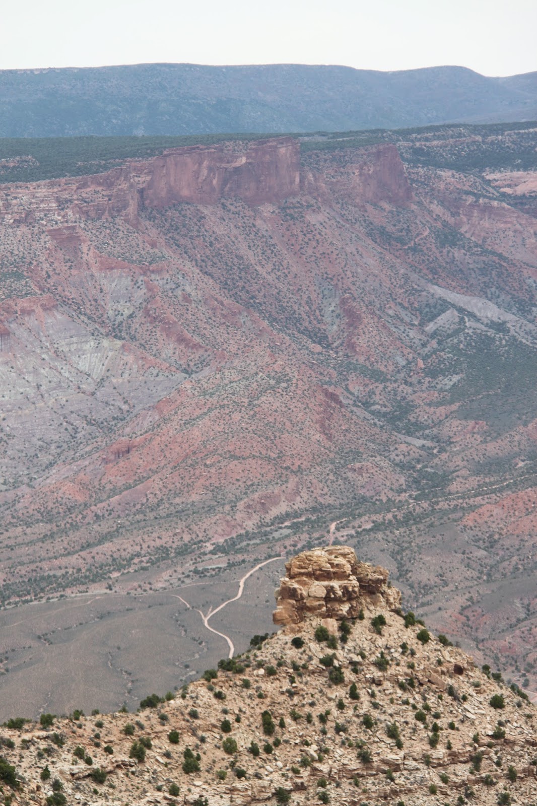
This is the Sheep Creek Trail.  The road easily seen in the bottom winds its way to just below the vertical cliffs at the top of the picture.  This narrow, steep shelf road can be a challenge in the spring due to erosion and rock falls.

 As it was, we picked up a hefty gunny sack full of cans and bottles along the trail and winched a large fallen tree from the trail.

The grand highlight of this trail comes at the end.  The views of the surrounding countryside are to die for.  Spectacular scenery greets your eyes in every direction.  If you are remotely familiar with the area, you will recognize many landmarks.

We could point out the Delores Overlook and the newly christened “Top II” trail where we had driven last Sunday.  Top II is the southern end of the up thrust mesa that graces the Top of the World trail of Moab fame.  From some viewpoints on Top II, you can see the terminus of Top of the World like nowhere else.

These spectacles from Delores Point made our lunches much more enjoyable.  Other trails seen from there include Sheep Creek, South and North Beaver Mesas, Polar Mesa, and the region around Rose Garden Hill.

Returning back from Delores Point, we continued to the South Beaver Mesa turn-off.  The South Beaver road starts out fairly mild and scenic.  But once you reach the hairpin turn, hold on to your seat --- tightly!!

Tom climbing the South Beaver Mesa trail.  Notice the severe erosion.

 From here, if you don’t like steep, narrow, loose rock, washed out with 2-foot deep channels, class 7 or 7+ shelf roads, now is a good time to just park and enjoy the scenery.  For the next mile or so, you WILL be paying close attention to your driving.

Off-camber, steep, and full of loose rock and sand, this trail WILL make you pay attention to your driving.  The scenery is over the top as well, IF you take a moment to notice.

 At the bottom of the steep part, there is an old shack and dugout cowboys or shepherds used -- we think.  It is set on the rim of the Beaver Creek Gorge in a beautiful setting.  In the dugout, you can still find bottled water and a can of Campbell’s Chicken Noodle soup that have been on the shelf for at least 7-years.

Stocked shelves in the Great American BackCountry are a rare find.

This is the "cow camp".  The small shed has a bunk bed while the dugout is stocked with bottled water and a can of soup.  A corral is to the right of the gate.
The dugout had a wood stove and bed springs for a short man.  Crutches still hang on the wall.


The road continues out So. Beaver Mesa, but is not very exciting as Jeep trails go.  So we began the slow, rough and rocky climb back out.

The trail is littered with fallen and erosion exposed rocks of varying size.

 At an intersection, we turned off the trail onto another faint road that brought us to another cabin and dugout.  This one was built mostly from area Juniper.  This is an unusual building material for a cabin.

Cabins built of Utah Juniper are rare finds.  That is cactus growing on the roof.

The dugout is also Juniper and a sod roof with cactus growing on it.  This would have been a pretty cozy place on a cold night.

The road continued in the general direction of the Gateway to Moab road, so we crawled along hoping it would take us all the way through.  Following my nose has often resulted in good things happening, and after quite a long time, we came to a familiar road that took us out to the road back to Gateway.

A herd of Mule Deer allowed a quick photo.

 Another superior day in the Great American BackCountry and another reminder of why I live by Yogi Berra’s “Yogi-ism”;  “When you come to a fork in the road, take it!”  That is where the adventure begins.


Copyright Happy Trails 4wd, 2017.  All rights reserved.

Monday, March 20, 2017

Delores Overlook and Others

By Jerry Smith


Yesterday, March 19, 2017, the majority of Grand Mesa Jeep Club participants headed for the Top of the World Jeep trail of Moab fame. Thirteen rigs left Fruita and assembled at the Dewey Bridge turn-off to air down. A 14th joined us there. Several other rigs passed by on their way to the same destination as trail preparations were made.


The Delores River from Delores Overlook

I had already informed trip leader Todd that I would not be doing Top of the World but would follow them to the trailhead, as that was on my way to the Delores Overlook trail and other area trails. Just before leaving the staging area, Tom asked if I would like some company, so Tom and Connie tagged along on one of my many exploration forays into the Great American BackCountry.

The short trip to the trailhead was one of severe dust. Judging by the way the thick, yellowish cloud hung in the air over the freshly bladed road, wind, or lack of it, would be a problem today. The line of intelligent Jeepers became strung out over great distances, the others, well… let’s just say they will need a new air cleaner.

The Delores River from Delores Overlook

As Tom and I passed the others, it was clear that their dust problems would be greatly lessened because their trail speed would be cut by about twenty miles per hour. The Red Rock 4-Wheelers rate the Top of the World trail as a 6 in their Easter Jeep Safari paper. When you drive the upper loop in a clockwise direction, you may think you’re on a 7 or 7+.

We, on the other hand, continued on the Entrada Road creating billowing clouds of choking dust. Except when stopping to pick up some O.P.T., I seldom saw Tom in the mirror. (O.P.T. is; Other People’s Trash). We did communicate on the CB so that there was some idea of where the other was.

The Sleeping Camel

Around 13-miles into the trip, we came to the first of two 4-way intersections. Continuing straight would eventually take you to the famous Rose Garden Hill. I had already descended Rose Garden twice this year. As obstacles go in the last few years, Rose Garden has gone from difficult to extremely difficult. On the first trip DOWN this year, we had to winch one vehicle that became hung up on a ledge. With the large rocks and ledges and all the loose rock and sand, ascending Rose Garden looks to be close to a Hammers type obstacle. You get a good mental and physical workout going DOWN.


The road to the left would take us out to the Delores River Overlook. This is a trail with some light challenges at first. Once you reach the mesa top below, the trail almost challenges you to see how fast you can drive.

The “overlook” is a spectacular vision. You are standing at the intersection of the Delores River and Cottonwood Canyon, only hundreds of feet above this eye feast. Today, the river was running a chocolate color liquid that contrasted with the red and cream colored cliffs reaching skyward from the milky waters.

Directly across the river is Steamboat Mesa. Steamboat is a massive flat top mountain setting on two sets of high vertical cliffs. From the top, the 360-degree views are just fabulous. If you are a bush pilot, you may land on the airstrip on top.
The Delores Overlook from a distance

Steamboat Mesa

The deep gorge of the Delores River is a sight all by its lonesome. The up-river view is hidden as the river bends back toward Beaver Creek and the Utah/Colorado border. Downstream is a wide and deep gorge with vertical cliffs rising to an arid Juniper and Pinion Pine forest. This is a wild and very remote country that demands respect. If you break or have a mishap, it may be days before you see anyone. In other words, come prepared or stay away!


About 11-years ago, I came across five people walking down the road toward Glade Park.  It was the middle of July and near 100 degrees.  They all looked tired and beaten although one was carrying a nearly full 3-gallon jug of water.  They were only in their second mile of walking what would have been about a 15-mile hike to the nearest occupied ranch.

Their car's starter had seized, so it wouldn't start.  We tried to jump start it with no luck.  I was driving a rental Jeep Wrangler and had no tools to help. So we loaded into the Jeep and headed for Glade Park where they happened to live.  Let me tell you, six people in a Wrangler is cozy, but they were extremely grateful for the ride.

After some short hikes to some better vistas, we loaded up to return to the Entrada Road and other trails. On the way to the Overlook, we passed some side trails that looked interesting. For me, ANY side trail has interest. Some of my club nicknames are “Side Track” and “Intrepid Explorer”. Hey, I EARNED those!

This formation is what I call the Sleeping Camel

At the first left turn, I had a feeling it would take us to the second 4-way intersection on the Entrada Road. After some sketchy “trail” following, we came to a familiar looking place where I confidently told Tom and Connie where we were. A while later, I was proven correct as we came to that 4-way as predicted.


As I had never explored the road straight ahead and this day was a day of exploration, we forged ahead. This road ascended to the ridge top and over the other side. Some pretty spectacular views graced us from the abrupt end of the road. The views off to the right toward Top of the World were very appealing.  Many times I had wondered about access to these points looking from the Delores Triangle.  The possibility that there was access was exciting!!

Tom coming down a small ledge

Returning to the Entrada Road again, we turned toward the first 4-way intersection and turned left up the hill again. This too was new territory to me. I had high hopes this would take us to one or more of the points along the same edge that the Top of the World trail takes you to. Top of the World is on a long ridge of an up-thrust mesa having a roughly 600-foot vertical cliff as the end point. The views from these points are indescribable. “Awesome” doesn’t approach the actual feeling.


The trail turned out to be a respectable Jeep trail. Just rough enough to keep you entertained, yet easy enough that a stock Jeep could make it with little trouble. With only one set of UTV tracks ahead, the trail didn't see much traffic.  


The panorama that revealed as we came to the first overlook made the trail pale on the one hand and made the trail a “MUST DO” on the other.  For a seldom used trail, this one is a real dandy!

From Top of the World, you get a sideways look into part of the Fisher Valley that is pretty cool with the La Sal Mountains over the south rim. From here, put those pictures away. The Fisher Valley will never look better. The ranch is fully visible in the upper end of the valley and the roads to Onion Creek and Rose Garden Hill are totally plain.

Slickrock is usually free of vegetation.  This tree has survived a long time on a hot rock environment.

The upper Onion Creek is also more spectacular from this angle. The upper creek wash is clearly visible and looks more rugged from here.

The trail begins to follow around deep gulches carved by eons of rain, wind, and snow melts to the next point that juts out into space. From here, views of the Fisher Tower begin coming into view. Add the Onion Creek canyon from the mid-point to your view along with the Colorado River and it’s quite breathtaking. Turn 180 degrees, and the view just keeps getting better. Now the Delores Triangle and all of its features are in view.

Looking over at Steamboat Mesa, the Granite Creek Gorge, Pinion Mesa, and all the other creeks and canyons can consume you. Knowing all the trails and sights over there make you yearn for more time to explore that world again. It’s an invitation.

We don't know which finally killed this ancient Juniper, but it appeared that lightning had split the trunk and it was in at least one wildfire in the area many years before.  I estimate the tree was 700 to 800 years old when it died.

Back on the trail again, we were again greeted by another overlook. This one required a short hike to the better vista point, but the walk was well worth the effort. Here, the Fisher Tower and Top of the World are totally visible and are absolutely incredible. The other views are equally mesmerizing. I think it was here that we decided to call this trail “Top II”. As far as we knew, the trail had no name up to now, and this seemed very fitting.

Now the trail continues over some slickrock type areas where it is followed using the “Braille” method. You must “feel” your way along as no tracks or trail are visible. Tom’s GPS was showing the road continued to a dead end, but there was a side road that appeared to loop back to the Entrada Road. On our way to the Delores Overlook, there was another side trail that someone had blocked with some deadfall. This is where I speculated we would return to the Entrada Road.

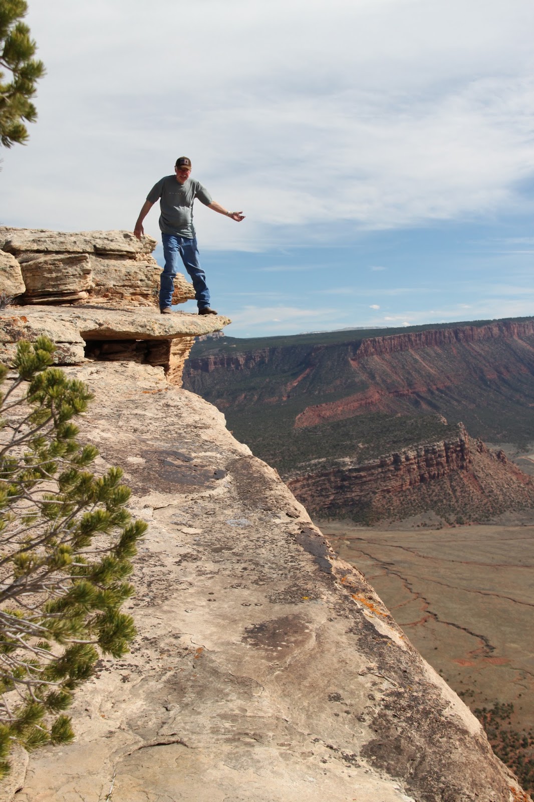
Tom braved a perch on an overhanging rock

But first, we traveled the dead end road to its conclusion. THIS road had some “interesting” obstacles that prompted us to discuss the difficulty of the return trip. Our speculation proved to be warranted as we struggled to climb the steep and rough obstacles on the return trip. Tom and I love trails like this.

Back at the first side road intersection, I built a cairn to mark the trail we were about to try. By now, both vehicles were showing an alarming lack of fuel, so concern for following this road was questioned. If it didn’t take us out to the Entrada Road, it could become a long walk out. Tom’s GPS and my nose made me confident we would be rewarded. Twice we came to places that put those guiding references in question. One place, the GPS showed us at a fork that wasn’t visible from the position we looked for it. After a turn in the trail, that intersection finally revealed.

The next alarm rang at a wash crossing. The wash was a wide slickrock bottom with no sign of a trail in sight. Going down the wash looked to end in a waterfall in the distance so my nose pointed me across and uphill where we found the trail resumed. A while later, we crossed over the downfall branches mentioned earlier and onto the Entrada Road.

Tom on a series of ledges

During this descent, we had been hearing CB chatter from the other group. We learned that Roy had a disabled Side-by-Side in tow and they were struggling to get back to the Entrada Road. We reconnected with the last of the group at that intersection finding trip leader Todd working on his transfer case linkage. At the trailhead, low range is no longer necessary, but his would not shift. Soon he had shifted from low to high range and down the road we went.

Tom and I had decided to cross the Delores River and go home by way of the back roads. At the crossing, we re-evaluated that notion. The sandbar normally visible on the east side of the river was well submerged in raging swift water. The docile river I had crossed only a week before was now at least 2 feet deeper and really rolling along. We would be returning by way of I-70.

Looking down the Colorado River Valley from "Top II"

Upon reaching the Fruita exit, we turned off looking for a place for a late dinner. The Mexican place had a parking lot full, so we went on to the Rib City restaurant. Surprise, club President Jeff
, and friends were there already eating, but we joined them anyway.

It was a great day on the trails of eastern Utah. It was also a reminder of why I live by Yogi Berra’s quip; “When you come to a fork in the road, take it!” You just never know what you may find.

Finding a Jeep trail of this quality and length is extremely rare in this time of trail closures.  Cherish the trails we have left and FIGHT for access to them. As the Director of Environmental Affairs for the United Four Wheel Drive Associations, I spend about 30 to 60 hours a week researching and writing comments to the BLM and USFS trying to make them understand what each trail means to motorized recreation.  For over 40-years, this has been a passionate effort for me.  One more trail closure is one too many.

On the positive side, moving to Grand Junction has been a blessing like being given the world.  The passion for exploration and the area's history of mining have provided us with many trails to enjoy.  Since 2007, I have found and REopened five trails closed by Mother Nature.  Two of them required help and the others I did alone.  REopening just one trail is a thrill that most will never experience.

We are presently working to OPEN one trail segment on the Tabeguache Trail.  The trail has been built, but the access to it is still in limbo after over 30-years of efforts by the Grand Mesa Jeep Club.

We have proposed several extreme Jeep trails and another "connector" trail to land management as well.  This is what an active club with superior leadership can do.  Building excellent working relationships with land management DOES work.  It takes immense time and patience to make it work, but the payoff is definitely worth the effort.

So, when YOU come to a fork in the road, take it!!  It may become YOUR favorite trail.

Copyright Happy Trails 4wd, 2017. All rights reserved.


Fisher Tower is the dark red tower next to the "V" notch.  The terminus of the Top of the World trail is above the four short spires.

The ranch in the upper Fisher Valley

Looking over Onion Creek canyon.

The Fisher Valley
On the trail